Any bike ride that includes the opportunity to sneak into a gated community is a good one.
Of course, that any bike ride is good is also axiomatic, and it is with that eternal truth in mind we once again headed out to end up riding pretty much every street, nook, trail, and cranny in Burque. Being old enough to have cycled quite a bit, we only reached the obsessive, completist stage somewhere around the time of the Pandemic. That’s left us with what is, for us, the strange, out of the way, and/or not generally considered “bikeable” parts of town.
Sunday we headed north and west into neighborhoods with names including Parklway, Las Lomitas, and Stormfront in a section of town somebody with a real estate license wants us to call “Lower Petroglyphs.”
Here’s the gist of Sunday’s ride:
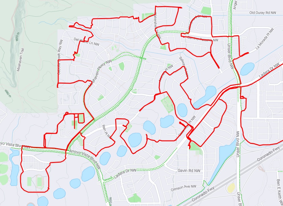
No, the route above isn’t your typical cycling journey, and, also, no we aren’t getting to every single nook and cranny. The human-created algorithm for the above and other such rides is based on GPS games Squadrats and Wandrer and a bunch of clicking around on the route-making function at RidewithGPS. For those too sane to click on any links in the previous sentence, the central concept of the game is to at least touch upon roughly every 1/64th of square mile in the area (Squadrats) while slowly pedaling along as many new streets as is possible given we have jobs and/or other things to do in our lives (Wandrer).
Throughout, the emphasis is on going slow enough to enjoy the view of our surroundings, regardless of how often that view is of a massive pick-up truck that hasn’t picked up anything but a guy with a big ass since its purchase. On streets with names like Cloudburst Drive and Casa Roja NW, one doesn’t get much over 10 mph, and such a saunter overall generally averages about 8 or 9, what with the stops for observations, hyrdration, snacks, and the occasional trip behind something/anything to pee.
Lower elevation neighborhoods in the “Lower Petroglyphs” were built in the early 90s (e.g., Las Lomitas), with new higher elevation subdivisions created in just the past few years after creation of the “Lower Petroglyphs Public Improvement District (TID),” an effort in government subsidy (TID = Tax Increment District) led by the late Ken Sanchez as member of the Albuquerque City Council.
I don’t know if it constitutes “Public Improvement,” but the main of the TID is a large gated Del Webb community butting right up to the National Monument fenceline. Having unsuccessfully tried the pedestrian gate next to the driving gate (that “1, 2, 3, 4” password almost never works), we were helped by an exiting resident and scooched in before the gate closed. With large signs about informing us…
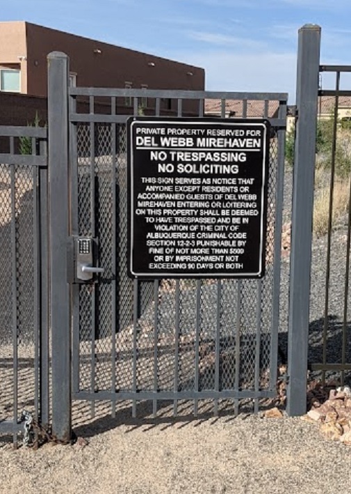
we made sure not to trespass beyond the public streets paid for by taxpayers through the TID and tried not to solicit too hard. Our excursion was notable on many fronts, including a subdivision-wide “poker race” event at which strollers or cyclists select a playing card at five tables set up around the place to draw the best 5-card poker hand.
Full Disclosure: While we didn’t play the game (it was evidently only really for strollers/walkers), we weren’t asked by a cycling gentleman “if we had any cards.” This blatant attempt at cheating was thwarted by us not having any cards. I admit I would have sold the guy an Ace or King for $20, however.
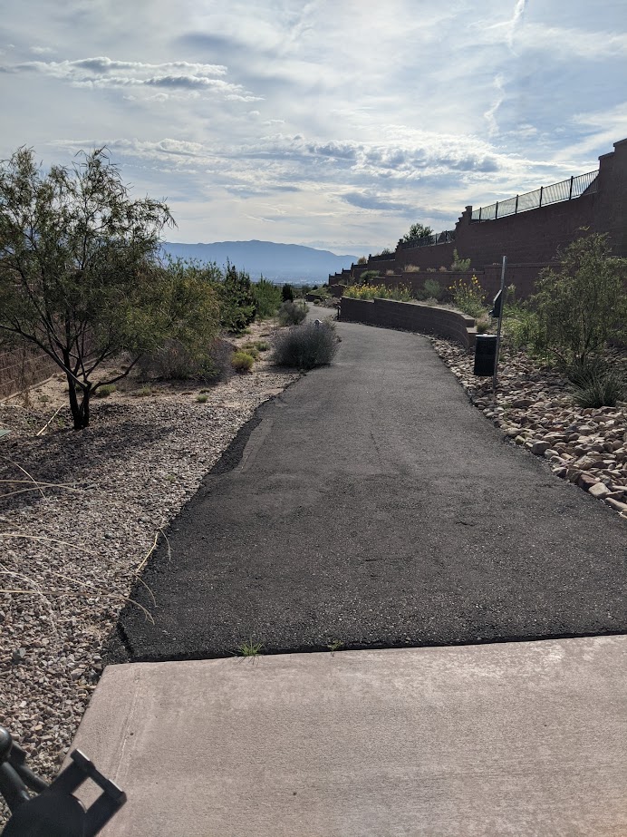
Often getting out is a bigger problem in accessing gated communities than getting in. Throughout our foray in getting 1/64ths of square miles we kept eyes out for exits, noticing the many, many community side and through paths. While, like pretty much any gated community, things were pretty sterile overall, the side/throughpath system was truly of the Cadillac standard.
Our exit was actually pleasantly given to us by one of the poker race table attendants (thanks!), and we were soon out to neighboring neighborhoods such as the “Stormfront” subdivision. It’s always fun to see/laugh at the street names and themes in any subdivision, but “Stormfront” is a veritable flood of weather-related terminology:
- Downburst Ave.
- Forecast Ct.
- Torrent Dr.
- Monsoon Rd.
- Jet Stream Rd.
- White Squall Dr.
And so forth..
Speaking of road names, on all these excursions we’re always on the lookout for additions to our informal Low Stress Cycling Network (LSCN), a collection of residential streets with mid-block crossings of major roads/stroads. As is true in many stretches along the West Mesa, my favorites this time were edge streets adjacent to the currently unhoused Mesa (principally Petroglyphs National Monument fenceline in this case). Streets like:
- Cebolla Creek Way
- Granite Mountain Loop
- Mesa Rain Rd. and connecting back through
- Watershed Dr. NW to cross Tierra Pintada all worked very well.
Another highlight of our trip was breaking into the parking lots surrounding Nusenda Community Stadium to get a few 1/64ths of a square mile not previously “got.” We noted others were also using the stadium, parking lots, and surrounding areas for recreation/dog training, etc., which makes sense for a facility that is isn’t hosting any events roughly 300 days out of the year.
We were also able, with some difficulty to circuit the running track at Tres Volcanos Community Collaborative K-8 across the street, overcoming, to an extent, the ubiquitous and universal fencing that now surrounds pretty much every public school in town. Along the way, somewhere amid crouching under gates and around fences, I lost my beloved pair of reading glasses after having them dangerously dangling on my shirt neck collar for thousands of hours/miles on many, many rides the past few years.
As much as I would like to charge APS for cost of the reading glasses, I guess we’ll just call it even for our arguable trespassing on public land.
As we often do these days, we began and ended our ride at a public park with a parking lot. “Parkway Park,” in addition to having a delightfully redundant name, was a lovely place to start and reconvene before heading home.
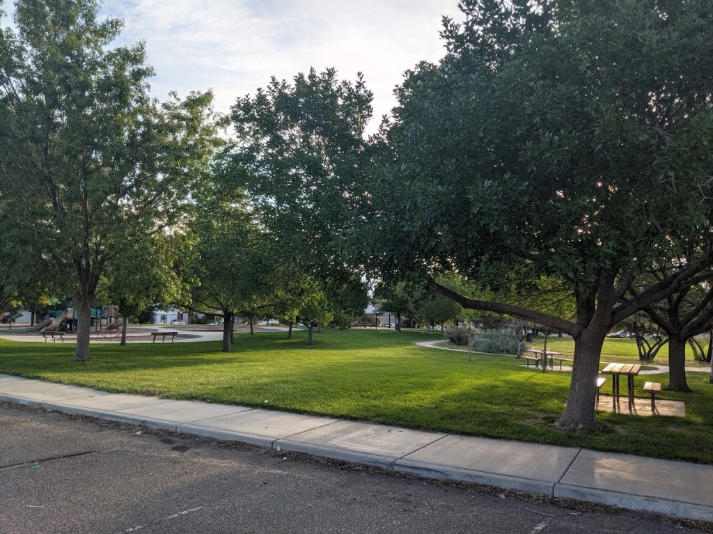
In case you’re wondering, you get to Parkway Park by entering the Parkway Neighborhood and parking at the park located on Parkland View Drive.
Stats for the ride of 9.10.23:
- Distance: About 14 miles
- Elevation Consideration: Maybe hillier than most, given there is a Mesa involved, but the grade was never more than 4.7% and our elevation topped out at 5,447 ft. Mean grade on the rise was 3.2%
- Little Libraries Spotted: Zero
- Approximate number of folks we spoke with beyond “Good Morning”: Three. The guy who wanted our poker cards; the poker card station attendant, and a woman watering her yard in a conversation that contained questions about Summer would ever end.
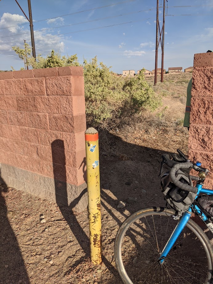
- Number of gates/fences crossed in some manner: A pretty high number this time. We also spotted and checked out The Daily Bollard (TDB) standing guard at a hole in the wall between homes and Ladera Dam #(I don’t know which one).
All in all, yet another good day for a bike ride (hint: they all are good days). While many folks outside these immediate neighborhoods don’t make it to Downpour Drive or Granite Mountain Loop, we definitely suggest you check it out. And bring some playing cards, Ace and Kings preferably, just in case.
