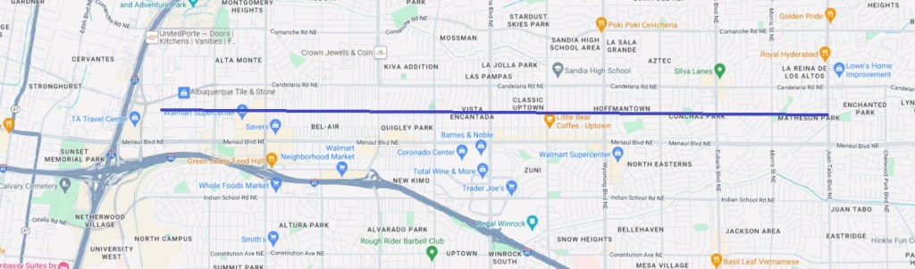
Continuing our series on proposed “Highest Priority” bicycle network improvements found in the new draft Bicycle Plan, let’s take another look at an oldie-but-goodie: Claremont from Richmond east all the way to Juan Tabo.

Converting Claremont from its existing and evolving (e.g., traffic circles here and there) designated “bike route” to a bona fide “bike boulevard” ready for riders from ages 8-80 (95 if you’re talking ebikes) has been discussed here and everywhere people talk local bike infrastructure for ages. Upgrading what is already popular for some to many more would add six miles of wonderful (with an exception or two) to our bike network.
Being optimistic (we’re known for our optimism), let’s say we’ve overcome some obstacles in creating an 8-80 riding situation all the way from one end of the line above to the other. Hundreds, if not tens of thousands of cyclists, and walkers/rollers who share in the boulevards wonderfulness, are using Claremont every day, all day. A guy’s gotta dream.
And let’s say many of these folks going westbound so enjoy the downhill Claremont boulevard experience that upon arriving at the western terminus at Richmond they ask themselves, “Now what?”
Here’s what.

Here’s the bird’s-eye view with a helpful green swath across the parklette green indicating that future Claremont/NDC connecting bridge.
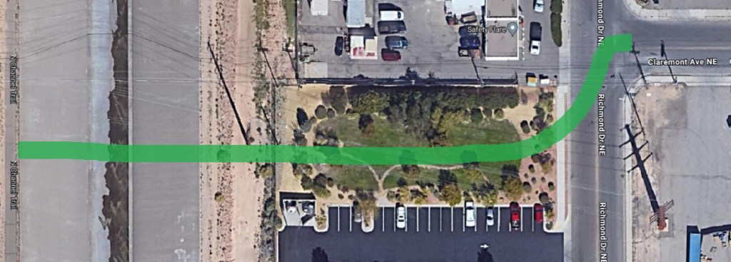
One of the many nice things about writing a blog to an audience of three readers is that I imagine each of you three has already spent countless hours staring at all of the above, has already checked the BernCo property parcel map to discover that the parklette is owned by something call Rich LLC, and has also rationalized the worthiness of such a bridge by relating it to that arroyo bridge the City built as part of its “50 Mile Activity Loop” a few years back that wasn’t really necessary because there was already a multi-use path on that side of the arroyo.

So just to sum up where all four of us are: If we built that Pennsylvania thing we can sure as hell build a bridge to the NDC through that parklette at Claremont and Richmond. But all four of us also know that’s never gonna happen unless one or more of us becomes Mayor or at least a City Councilor. So to answer the “Now What?” question, here’s the current answer with a revised recommendation.

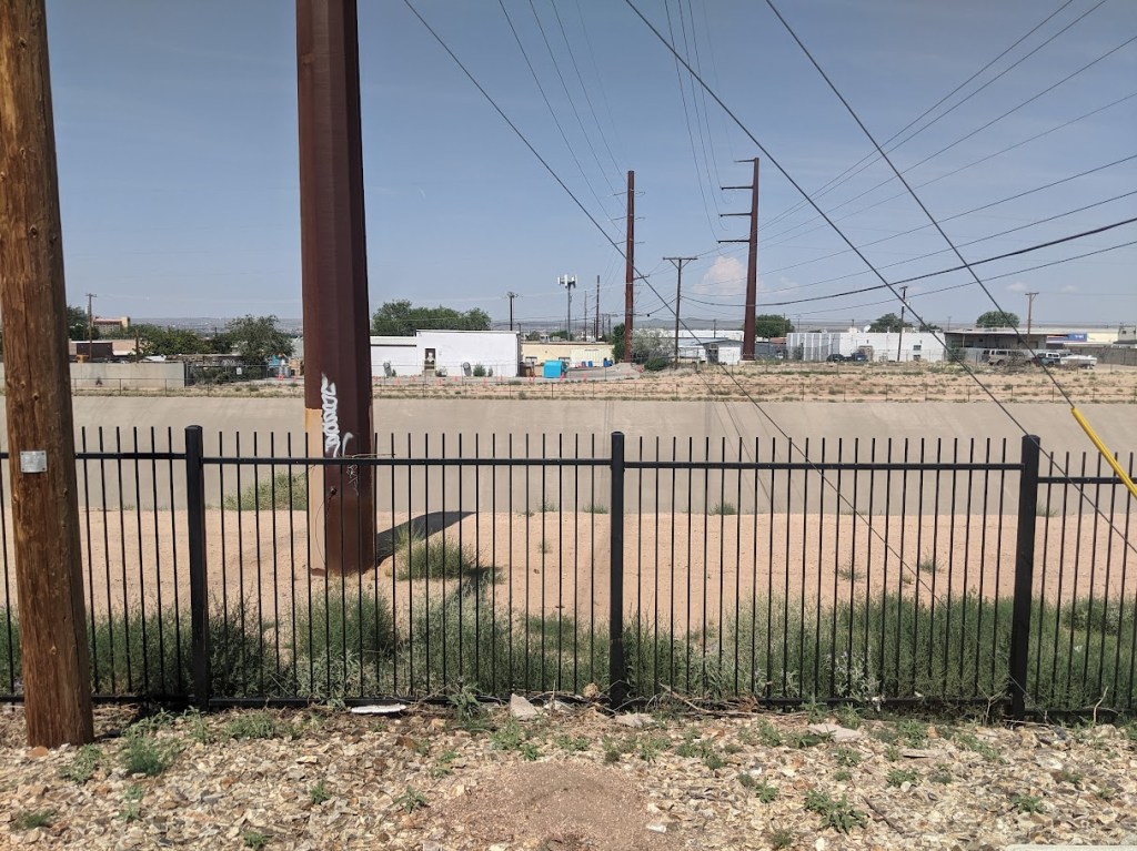
And here’s what it looks like when you get to the NW terminus of the red Italian flag swath above at Candelaria and the NDC.
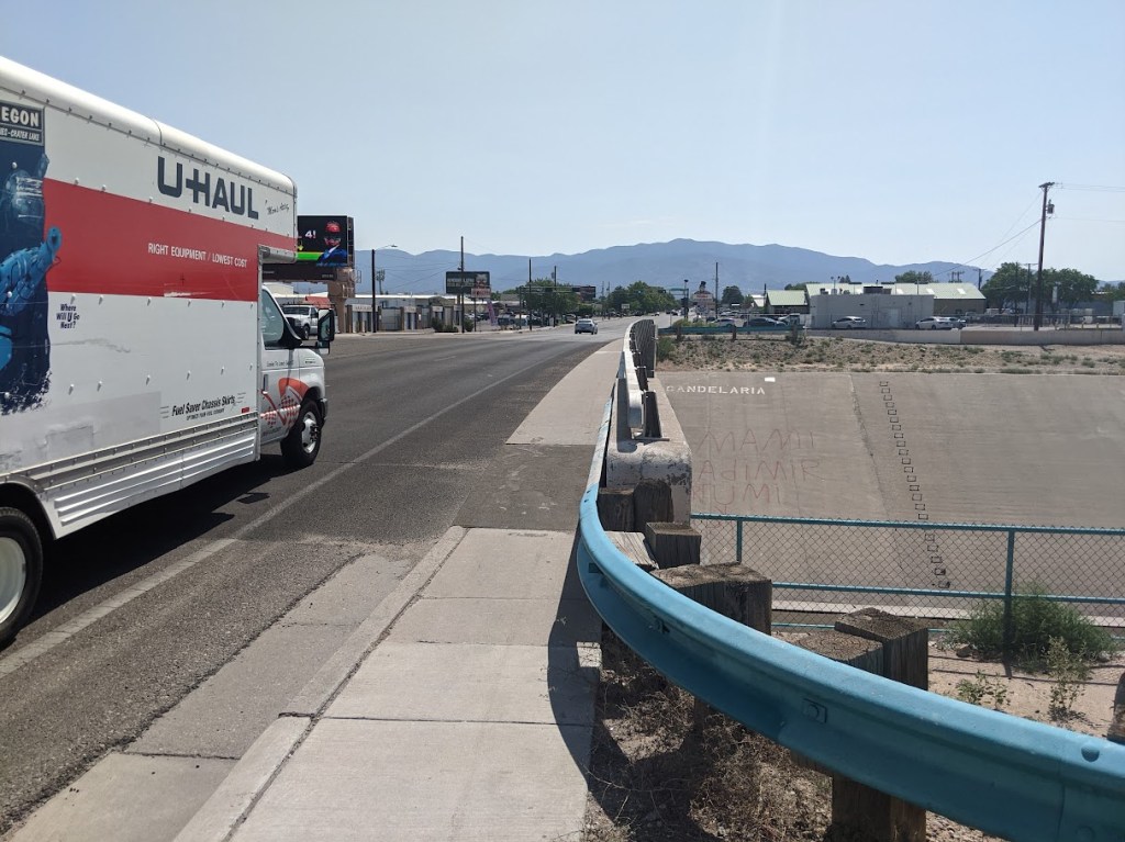
So here’s how we answer that “Now What?” knowing that you and I will never become Mayor or even a City Councilor. We build a concrete-separated two-way multi-use path running on the south side of Candelaria from Richmond west to the NDC. And/or we build a new bridge with such infrastructure at Candelaria and the NDC because that thing is sixty years old and looks it.
Yes, what we’re proposing here is a set of bike boulevards and multi-use paths that would get non-motorized walkers/rollers all the way from Juan Tabo and Claremont to not only the North Diversion Channel Trail, but from there to the Bosque Trail, and from there to places like Valle del Oro National Wildlife Refuge so many miles away that your humble blogger can’t count that high (or is too lazy to look at maps and count it up).
Naturally, you’re one step ahead of me and already thinking about other nearby connections needing work that would extend a Claremont experience even further (e.g., making it possible to stay alive crossing Menaul at Washington to get to Claremont), but let’s keep things “simple.” Let’s “simply” fix crossings such as Claremont at San Mateo and implement the Candelaria two-way multi-use path solution proferred above.
A simple answer to “Now What?”
