
Attending the recent sparsely attended Bernalillo County public meeting on its update of the “Pedestrian and Bicycle Safety Plan,” it occurred to me that entitling the session “Free Cheetos!!!” at the South Valley Multipurpose Senior Center would have better filled the approx. 80 chairs laid out by staff for the presentation. I counted seven citizens amid about the same number of County staff and Plan contractors.
And there were free Cheetos. I restrained myself to one bag.
The Plan is an update of the 2012 document which, they tell me, has guided transportation policy and spending to a meaningful extent over the past 12 years. In case you weren’t one of the six other citizens in attendance at the public meeting, here are a few important details.
Distilling the presentation slide deck and presentation boards, the gist of the Plan centers on a list of prioritized projects (some partially funded, most not) further prioritized at four levels, “Priority 1” below being the most critical.
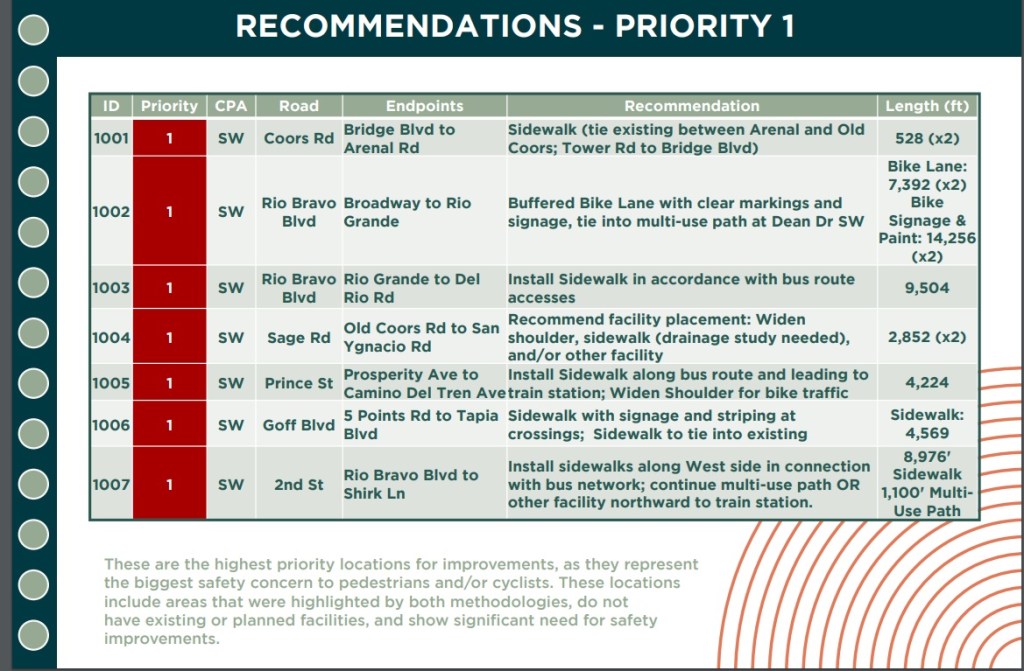
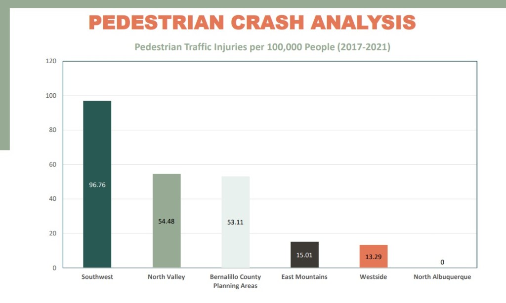
The methodology mentioned in the caption above refers to a combination of “High Fatality and Injury Network” (HFIN) data identifying precise location of ped/bike crashes and equity concepts such as income, race/ethnicity, ratio of household vehicles to number working, etc. The Priority 1 list makes sense with such criteria, and the P1 projects just all happen to be within three miles of my house in the far South Valley.
Hence, I came from the meeting feeling like the winner on “The Price is Right,” albeit with sober realization that unlike that vacation to the Bahamas Bob Barker told me I definitely won, we South Valley folks instead get a list of work that has various chances of getting funded while people continue to die due to the horrible current infrastructure.
In particular, the Plan’s identification of improvements desperately needed along Rio Bravo Blvd. (aka NM-500) means coordinating with NMDOT, as it’s a State road. This need for coordination is heightened by the State’s current/future work along the stretch, including replacement of the Rio Bravo bridge over the Rio Grande. There’s also “buffered bike lanes with clear markings and signage” mentioned, a treatment that has been incorporated (poorly) at scattered points along Coors Blvd., another State road (NM-45), but never before on Rio Bravo, a stroad even more highway-like than Coors (and that’s saying something).
To save those interested some time, here are the lists at the three other priorities levels:
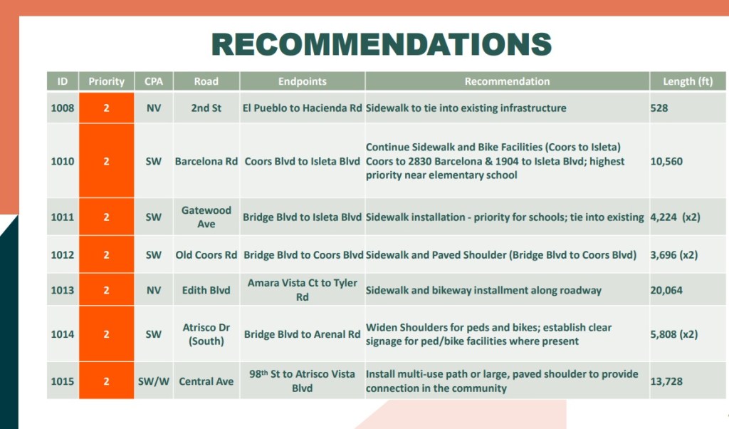
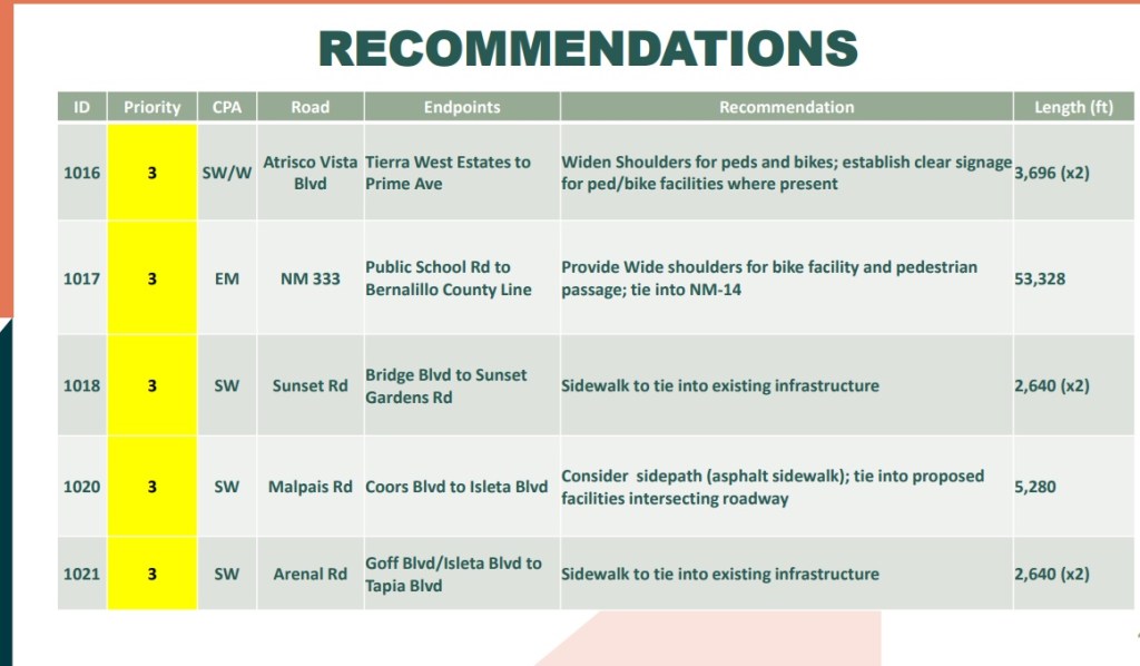
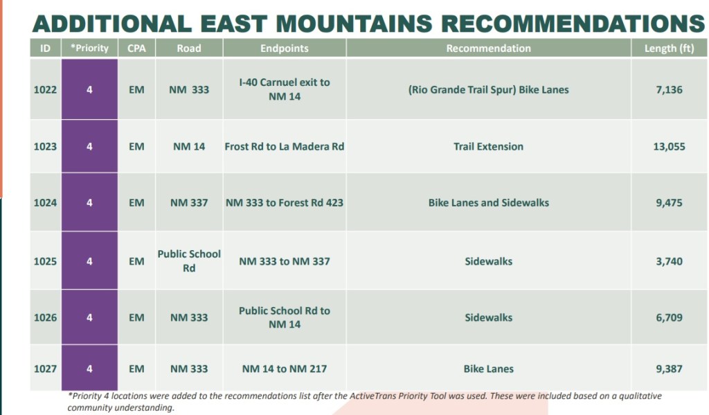
My South Valley continues to dominate Priorities 2 & 3, and there’s also recommendation for a multi-use path or sidewalk for over 13,000 feet along Central Ave. all the way from 98th St. to Atrisco Vista. That won’t be cheap. Maybe it has something to do with the ill-fated, ill-conceived City Visitor Center.
Those interested in finding out more regarding this Plan can check out its webpage and sign up for email updates. Based on attendance at the public meeting, one gets the impression interest is not widespread. Scant attendance has always been the case at such things (maybe the public is not aware of the free Cheetos!), but there’s also the Pandemic hangover. Heck, this was my first public meeting, as I recall, since we shut down in 2020.
Footnote, and decent evidence why maybe you should go to these shindigs in addition to free Cheetos. I happen to live really darn close to the unfortunately named “Gun Club Rd. S.W.” down here in the Valley. Sitting at the presentation, I noticed the prevalence of red and white dots on the map below.

That’s four red and white dots on a road that only gets about 5,000 drivers a day (as opposed to adjacent Isleta Blvd, which gets more than twice that). Looking at the four levels of priority, one does not find Gun Club listed. So I took a break from chomping on free Cheetos to ask about that, and the staff/contractors seemed to listen to my question while also seeming to ignore how orange my mouth and fingers were.
So maybe it’s worth going to these public meetings. Maybe.
