
Your humble blogger told an outrageous fib the other day. I declared that the City of Albuquerque has zero bike infrastructure signs pointing out landmarks and such. Not true!
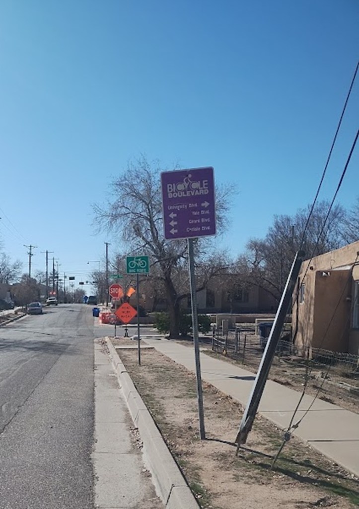
As shown in this horribly out-of-focus photo I took yesterday, the City’s Silver Bike Boulevard has the occasional sign such as this one. We could point out that the info on the sign above isn’t terribly important, particularly for cyclists and that the sign was obviously created and installed by people who don’t ride bicycles, but we’re not doing that. The point is that I was wrong and the City does have a few of these signs.
And they’re all/almost all (I could have forgotten one or two elsewhere) tied to a piece of Burque bike infrastructure that has reached that wonderful stage of being taken for granted. From my South Valley mini-farmette I ride the Silver Bike Boulevard from Presbyterian Hospital up to near Carlisle (stopping at Limonata restaurant, great crepes and vibe, you really should try it!) pretty much every week. Many cyclists ride this stretch, and I ride among them up and down Silver while also seeing them pass as I chug coffee and chew lingonberry crepes at Limonata.
I/we don’t know how many cyclists a day ride this stretch of Silver Bike Boulevard, because we don’t count stuff like that here (and we’ll get back to complaining about that lack of counting in another blogpost). But it’s a lot. Outside of the Bosque path, it’s doubtlessly the most popular stretch in town (sorry North Diversion Channel) and more importantly it’s the busiest stretch of urban cycling in town. Nowhere else do you see so many cyclists around drivers, parked cars, intersections, etc.
The number of cyclists and ratio of them to drivers is such that it’s the only stretch of urban riding in town that feels owned by the cyclists. It’s our place. The infrastructural reasons for that can be found below, but let’s start with an observation.
Yesterday morning I’m leisurely riding back down from Limonata, when I’m suddenly followed by some driver who probably got sick of how slow Central Ave. is now (yay, ART and traffic calming!!!) and chose to shoot down Silver instead to save time. He barrels up to me riding downhill, pretty much smack dab in the middle of Silver, as I amble down from Limonata toward Girard at a bit under the still-posted 18 mph speed limit.
The impatience of the driver is almost literally palpable. I have one of those dorky cyclist rear-view mirrors you put on your helmet and looking back the impatience was unmistakable. The driver wanted to pass me but the many parked cars and my tendency to be pretty much smack dab in the middle of the street overcame even his (I’m gonna assume that’s the right pronoun) impatience. Looking ahead I saw the approaching diverter at Siver and Girard and my glee in knowing about it was compounded by the sense that this driver probably didn’t.
Oh what fun!
To be honest, the driver didn’t even make it to Girard. They’d had enough and turned left at Dartmouth, before Girard, in a grandly testosterone-laden manner illustrating their umbrage that there exists an urban street in this town NOT owned by drivers. Let us complete this ode to the Silver Bike Boulevard by outlining why this is the case.
No, Silver Bike Boulevard is not perfect. Technically, the Boulevard runs all the way from the Bosque to Monroe near San Mateo, but stretches such as the part on Mountain Road is “share the road” bullshit because it’s designed for drivers. Then there’s Downtown, where Silver has been closed at 4th for a variety of reasons pretty much ever since 9/11, and getting across I-25 there’s still no tunnel or bridge, so it’s your choice of riding poison on Lead, Coal, etc.
So we’re really talking the stretch between the Hospital and, let’s say, Washington. That’s where you see 95%, or more, of the riders, and here’s why: Diverters, parked cars, traffic circles, more parked cars, and more diverters. Let’s list ’em going west to east:
- Diverter at Sycamore, east end of Presbyterian Hospital prevening through drivers
- Parked cars
- Diverter at University preventing left turns and through drivers
- Parked cars
- Weird combo diverter/right-turn only at Yale
- This part doesn’t have many parked cars
- Traffic circles at Cornell and Princeton
- Neither does this part
- The aforementioned diverter preventing left-turns and through drivers at Girard.
- Parked cars
- That little protected middle of the road cycle track up the hill on Carlisle by the Coop
- Some parked cars
- Diverter preventing westbound drivers, but not cyclists, at Morningside
Typically, your humble blogger would hunt down and post Google Streetviews of all these, but the fact is roughly 100% of you reading this blogpost have already cycled this stretch, probably many times, and have already seen all of the above first-hand. And that’s testament to how great this stretch of the Silver Bike Boulevard is compared with any other urban stretch of road in ABQ, and also the reason why I forgot that there’s still a few remaining wayfinding signs posted along the path.
This stretch of Silver has reached that Burque unique pinnacle of urban cycling infrastructure that comes with age and usage. It’s now just part of our town, a neighbor that has been around so long it’s just part of what constitutes living here. This post is my penance for taking Silver Bike Boulevard for granted and big thanks to that impatient driver yesterday morning for reminding me that we shouldn’t forget how good we, at least in this one little stretch, have it.
