We treat such incidents as “unavoidable” in the larger sense, the cost of doing business in having what amounts to an auxiliary interstate highway parallel to I-25. That the stroad has many businesses and places to live adjacent to it has heretofore been considered just part of that “doing business.”
With this is mind, and with a mindset that such deaths are avoidable, here is a bit of visual context for last night’s death at the intersection of San Mateo and McLeod Road NE.
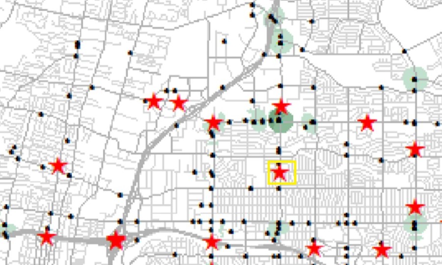
Bernalillo County Crash Data for 2010-2014 shows the San Mateo corridor to have the 2nd highest number of pedestrian crashes in the city, and 2nd highest number of bike/ped crashes per mile.McLeod Rd. crosses San Mateo in a “mixed-use” neighborhood of commercial/industrial, large apartment complexes, retail/services, and even nearby Cliff’s Amusement Park.At ground level, note the gentleman waiting to cross San Mateo and the person at the bus stop. The guy waiting to cross has a long wait, and will have seven lanes to cross once the light finally changes.Moving our view to the west side of the intersection, we see a Circle K, and yes, it sells beer. We also see someone “jaywalking” into queued traffic a few yards from the intersection. Many would tell us “that’s the problem right there,” but given human behavior, what incentives could be put in place to not cross illegally and do so in a safer manner?Looking again at the 2010-2014 data, red stars indicate deaths from walking ABQ roads, and black dots non-fatal pedestrian incidents. The yellow box illustrated a death a couple of blocks north of McLeod on San Mateo during the 2010-2014 reporting period.Over 30,000 drivers per weekday use San Mateo in the stretch including McLeod Road. It’s an extremely important roadway for many of us. “Trouble” is, it’s also extremely important for those not driving motorized vehicles.