Albuquerque City Councilor Klarissa Peña has very rightly proposed to spend the money needed to make Coors Boulevard from Central south through Rio Bravo/Dennis Chavez Boulevard significantly safer for all roadway users. As a deep South Valley resident myself, I have seen upclose the dangers of this stretch, to the point that I just don’t drive/bike/walk on/along Coors anymore.
It’s just too dangerous.
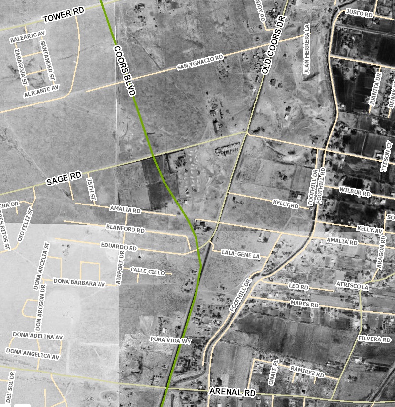
One way to better understand the current dangers, especially if you don’t make it down here very often, is to look back through a contextual history of this stretch of roadway. Accessing the hugely useful City of Albuquerque historical aerial map webpage, here’s a look, in three photo sets to give more detail, of development along the Tower Rd. (just south of Central) to Rio Bravo/Dennis Chavez stretch of Coors looked like back in 1916 versus 2018.
Coors from Tower Rd. to Arenal Rd.

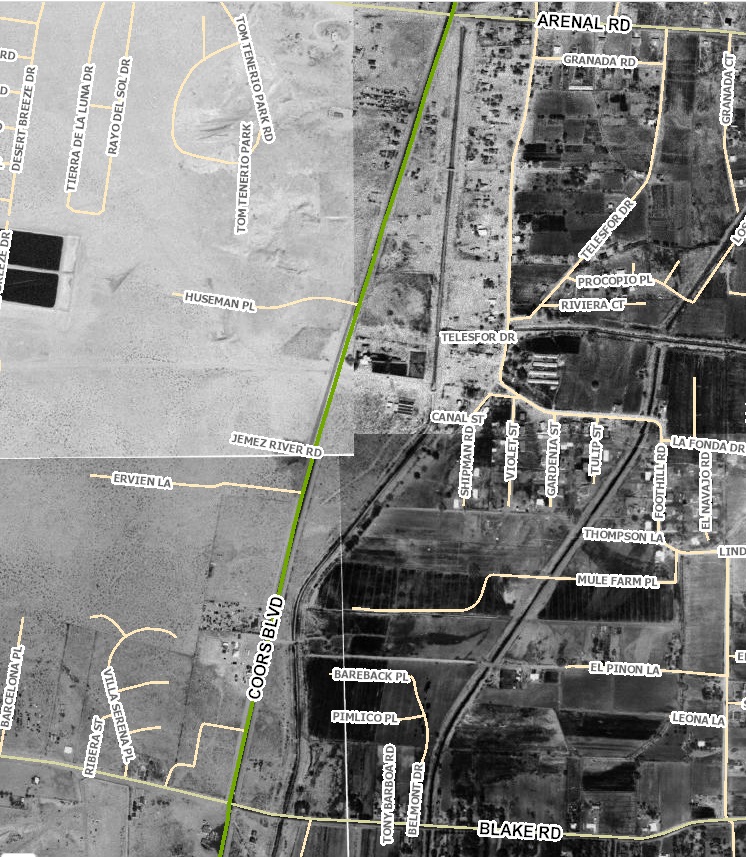
Coors from Arenal to Blake Rd.

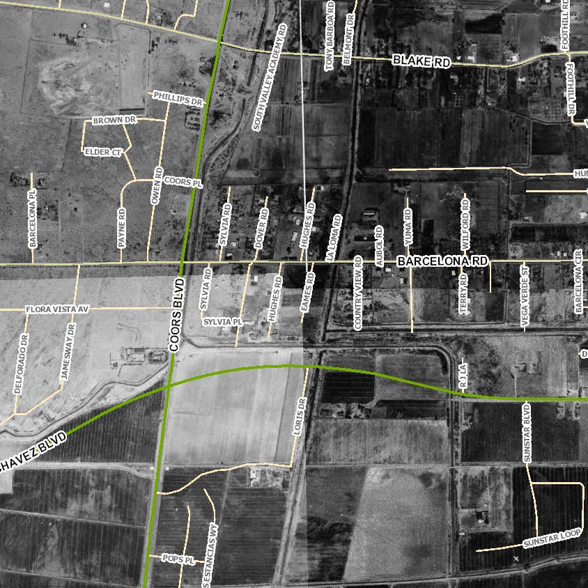
Coors from Blake through Rio Bravo/Dennis Chavez Blvd.
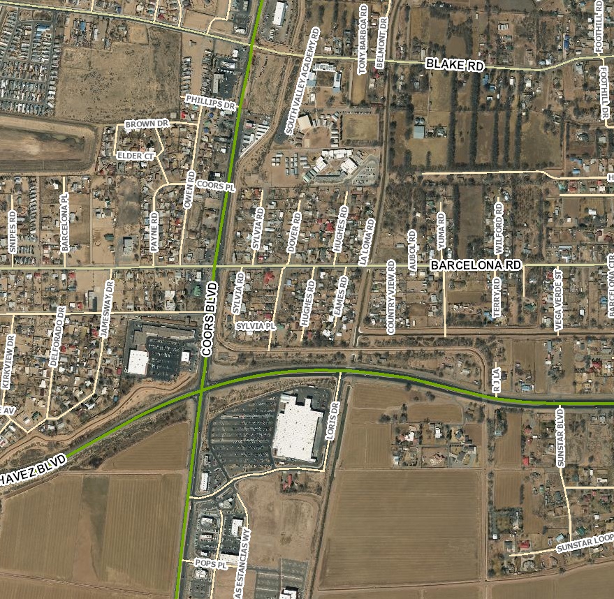
As you can see, especially if you squint, the differences go FAR beyond black & white versus color aerial photography. All this development has occurred along/near Coors Boulevard since 1961, with dramatically risen motorized and non-motorized traffic volumes to match, yet its roadway infrastructure continues to look much more like it did in 1961 than it should look today. Almost nothing has changed.
And what has changed far too often looks like this:

The last sixty years of this stretch of Coors reflect its transformation from sleepy agricultural/sandy throughpoint to glance at while whizzing by to a semi-urban/urban community of big box stores, strip malls, and high-density neighborhoods sprinkled with the few remaining farms and farmettes of the South Valley. It’s changed down here, but the highway everybody (but me) takes to get to Starbucks, Walmart, and other venues down here hasn’t.
Hence, Councilor Peña’s initiative to address Coors is greatly appreciated and far overdue. About sixty years overdue, really. One huge reason/obstacle for this is that Coors Blvd. is “NM-45,” a state road overseen by a notoriously antiquated and speeding car-centric New Mexico Department of Transportation.
Kudos, support and best of luck to Councilor Peña on this effort. It’s gonna be a “heavy lift.”
