
Few single words raise more ire in our beloved Middle Rio Grande Valley than “Santolina.” For many, particularly down in my neck of the South Valley woods, it’s a curse word, an expletive that locally replaces all seven of the words George Carlin discussed way back when.
But let’s talk Santolina. Yeah, I’ll even use the dirty word.
For a number of not terribly interesting reasons, at least not interesting for many people yet, I’m doing a bit of research on Santolina and transportation out on the far Southwest Mesa. My guess is that you kind readers out there might be seeing more on this in coming months.
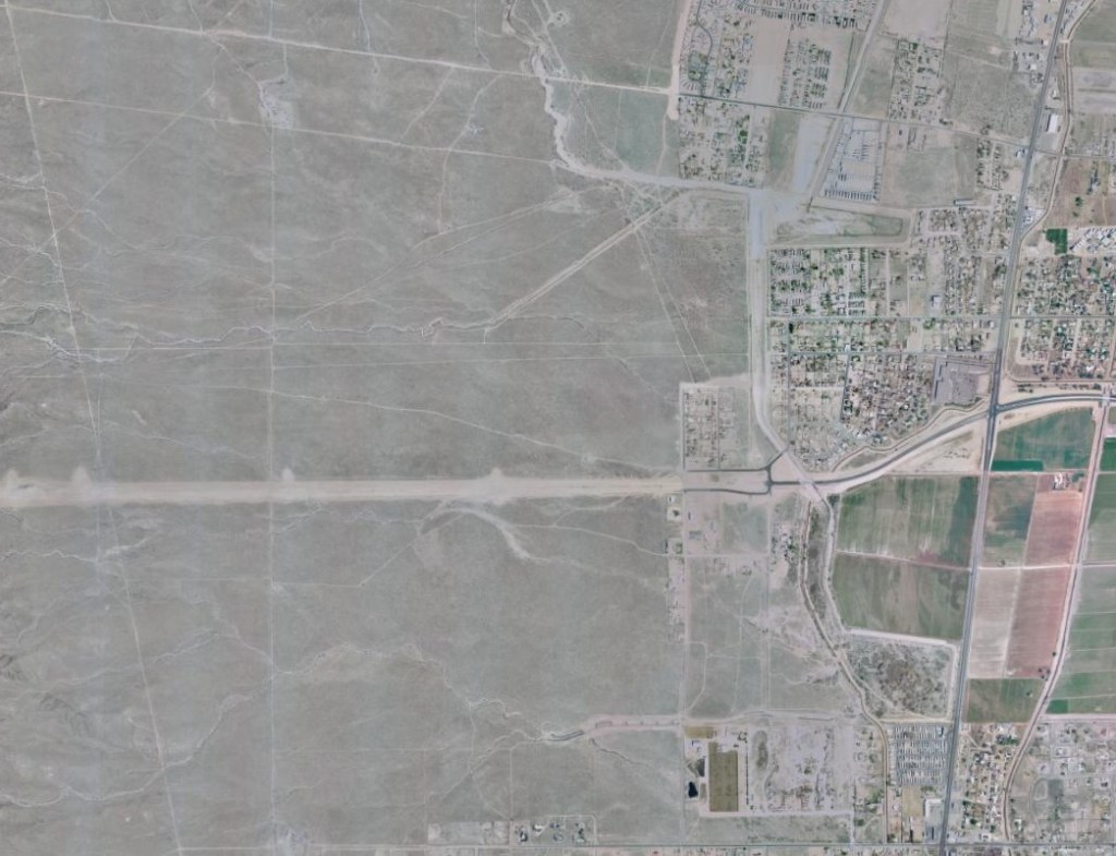
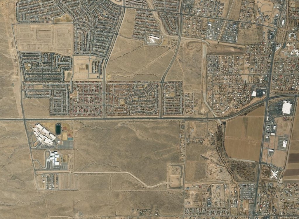
Putting the myriad obscene issues many folks ascribe to the dirty word aside, for a moment, I’ve started with a look at how the SW Mesa has developed in recent decades. Having lived in the far South Valley since 2000, I’ve noticed a bunch of development up on the Mesa, but that growth over time kinda blurs together. Using the extremely wonderful maps at the CABQ Historical Aerial Map webpage, we’re able to sharpen the blur, so to speak, and compare more starkly how things looked back in, say, 1999, versus the most recent such map in 2018.
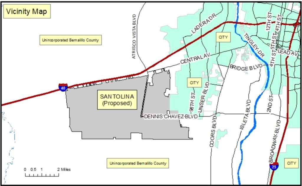
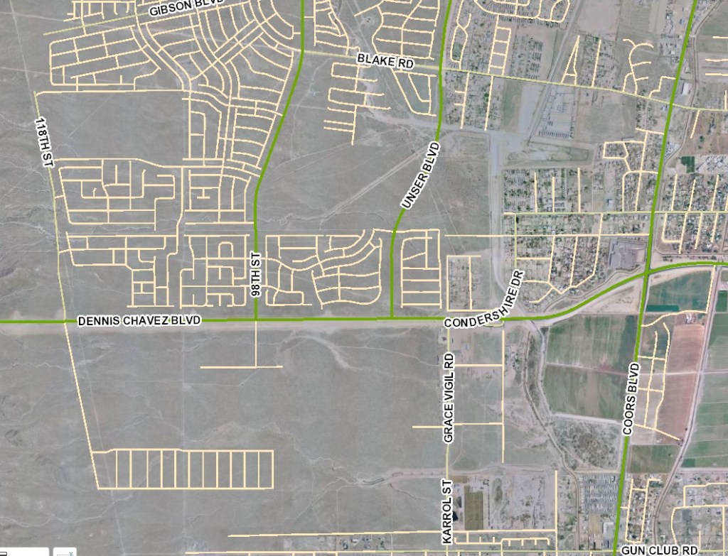
First, as we’re talking “way out in the middle of nowhere,” to many, let’s orient folks to the area:
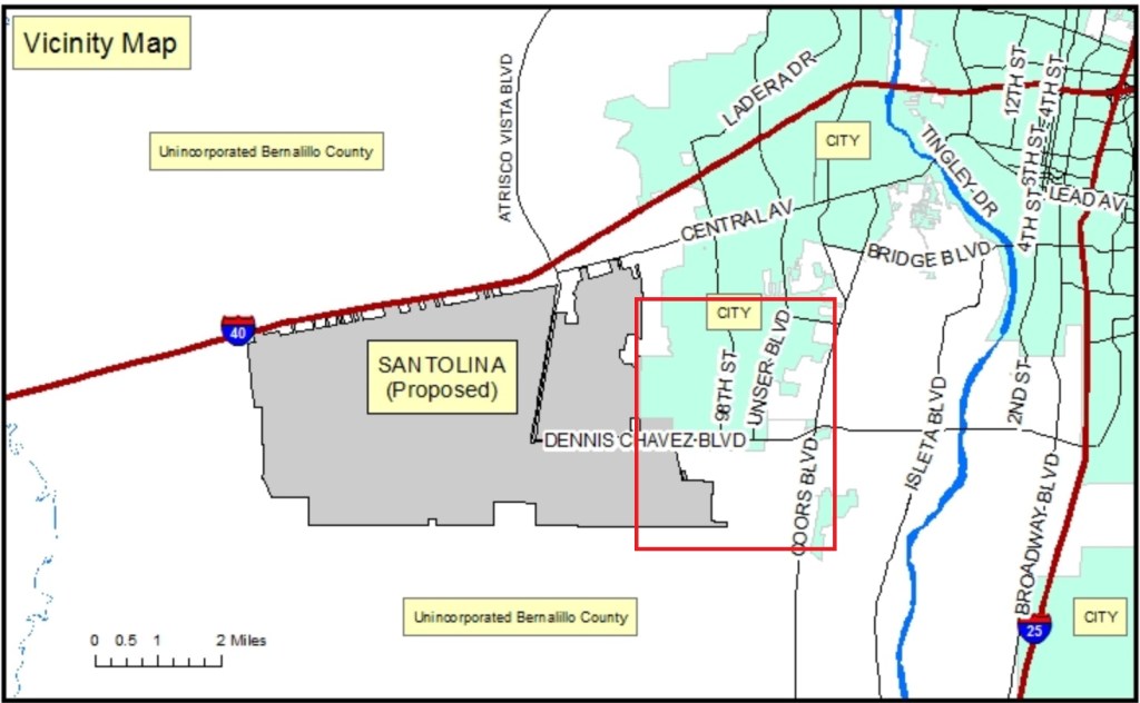
To further that orientation, I’ve inserted a red rectangle below identifying the area generally looked at in the aerial maps to follow:
If you haven’t played with it/them before, the City’s aerial maps have little sliders that allow one to transition from one map to another, including a very cool blending look via its layering feature. I’ll let you have fun with the blending, and here just present how the red rectangle area outlined above first looked in 1999 and then 2018:
For additional orientation, let’s take the 1999 map and add the layer with streets as of today in 2021:
While the headline of this blogpost overstates/misstates things a bit, the past 20 years have seen a level of SW Mesa development that can be useful, I think, in better planning further development out here, whether it’s called the dirty word or not. It’s also worth noting that this “Santolina 1.0” would have most likely been far more dramatic if not for the Great Recession in the late 2000s.
And with that recession and development slowdown, I think we got real lucky from a non-motorized transportation standpoint. Because, maybe, just maybe, we can avoid all the driver-centric planning very much in evidence from what did get built in the past two decades on the SW Mesa, and instead incorporate true “complete streets” transportation infrastructure in whatever development happens in decades to come.
Whether that development is called a dirty word, or not.
Most likely more to come about all this in future BB posts.
