
The Better Burque Tactical Urbanism Team (BBTUT) recently biked along, close-to, and sorta close to the proposed route for the Albuquerque Rail Trail, still unimaginatively named “Albuquerque Rail Trail,” from the Rail Yards at 1st Avenue up to Lomas and 1st Avenue. Of most immediate importance, we got to see the current state of construction on the proposed Trail’s very first bit o’ work, the grade-level track crossing at Marquette.
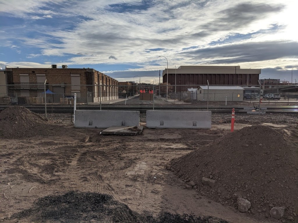
Admittedly, two jersey barriers and some piles of dirt is not that impressive, but look upon ye eventual works and admire the glorious crossing as ambitiously rendered in the Plan proposal:
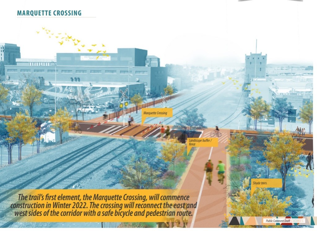
As noted in the graphic above, the crossing is particularly important to the Plan, as Marquette is to be the point at which the Trail goes from the east side of the tracks to the west side. BB apologizes for its relative lack of rendering budget, and talent, but the route is planned to look something like this:
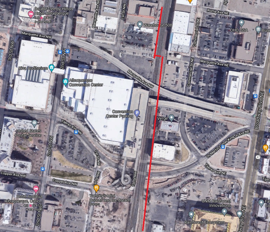
Worth noting is that the actual plan is WAY more complicated than the crude red line segments above, due to the fact the Convention Center (and parking) was plopped along the tracks and bifurcated 1st Avenue. It’s so complicated, in fact, that BB doesn’t have the Holiday energy to even get into it right now.

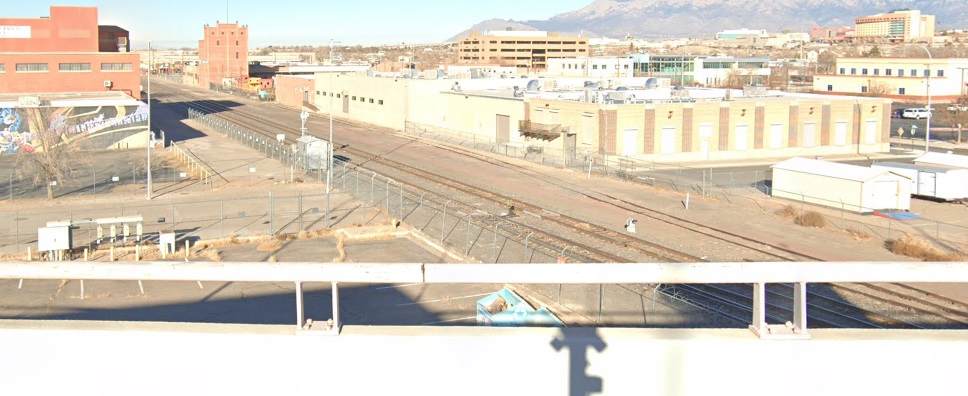
Speaking of obstacles, it’s a funny little side-note that not too long ago the strange little street that is Marquette ended before the tracks at this little shack:

The little shack above enclosing equipment to remediate the “Fruit Avenue Plume” was removed in 2018 after EPA decided such active measures weren’t needed anymore. There was opposition to this EPA move, in particular from the ABQ/BernCo Water Utility Authority, but it happened and that decision played something of a butterfly effect role in freeing up Marquette as a track-crossing street. You just never know when a dry cleaning business back in the early/mid-20th Century might somehow, some way lead to possible development of a rail trail almost a century later.
The Marquette Crossing is a good idea whether the Rail Trail happens or not. There’s currently no grade-level train track crossing between Lomas and, believe it or not, Woodward three miles south. The many over and underpasses downtown (e.g., Marquette, Central, Lead & Coal) are notoriously unfriendly to walkers/cyclists outside of the annual Dr. Martin Luther King, Jr.’s Birthday March, when MLK/Marquette is closed to drivers.
So that’s good, but what about the Rail Trail plan overall? We’ll look more closely at those aforementioned complexities and obstacles in future posts, but in a very short spoiler alert: I’m not sure anything “Rail Trail” beyond the Marquette Crossing ever gets built.
More on why I’d bet against it (acknowledging that I’m the world’s worst/best loser of wagers, ever) later on post-Holidays. Happy continued Holidays, everybody!

How did the railroad ever allow an at grade crossing to happen anyway? BNSF has been closing rail crossings when they can and not allowing one where federal funds were used to build a trail that now officially stops (without a nearby detour) at the rail tracks. This is the Las Cruces Outfall Channel Trail.
LikeLike
Very interesting point you raise, Mr. Pearson. I’ve wondered the same, and before delving too far into it direct you and readers to the “Steering Committee” members of the Rail Trail https://www.cabq.gov/mra/documents/2021-11-22-part-i-rail-trail-exec-summary.pdf:
Steering Committee
Mayling Armijo, Bernalillo County
Dale Armstrong, TLC Plumbing
Lola Bird, Downtown Mainstreet
Ed Garcia, Garcia Automotive Group
Seth Gardenschwartz, JS Brown Building
Johanna Gilligan, Homewise
Maria Griego-Raby, Contract Associates
Dennis Gromelski, Fusion Theatre
Frank Martinez, Citizens Information Committee of
Martineztown
Tim Nisly, Barelas Community Coalition
Jay Rembe, REMBE Design and Development
Matt Tinney, Albuquerque Police Department
Laura Trujillo, Valley Area Crime Prevention
Kelly Ward, Innovate ABQ
Richard Yates, Zydeco & Springer Square
Interesting names, no?
LikeLike
[…] laughed hard to the point of passing out in their N-95 masks. Remember, this was prior to even the new grade-level crossing at Marquette and the train tracks, which seemed marvelous at the time and still does. But there’s no […]
LikeLike