
Here’s something you probably don’t hear much in coversations between Albuquerque cyclists…
“Yeah, yesterday I was out for a ride and took that bike lane on San Mateo at I-40.”
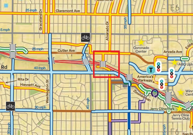
Did you know there’s a bike lane on San Mateo Blvd.? I only know because I was staring at the .pdf version of the City’s bike map last night and came across:

What the hell???
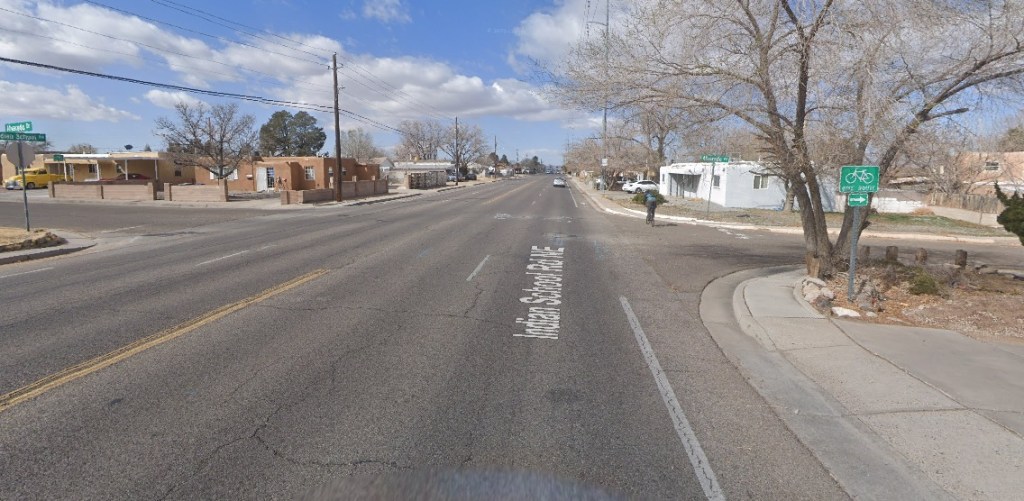
As you, fellow Albuquerque cyclist, are sane and sensible enough to read Better Burque, you probably have NEVER ridden a bicycle on the City-designated bike lane on San Mateo Blvd. from Indian School north through the I-40 interchange. So here are a few Streetview screenshots, first looking back northbound and then moving northbound provided without comment:
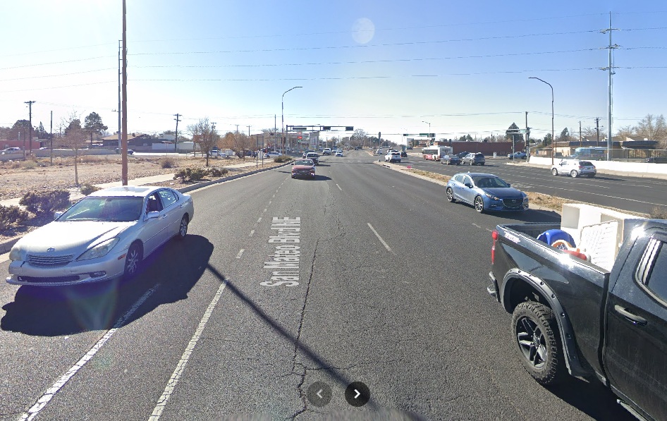
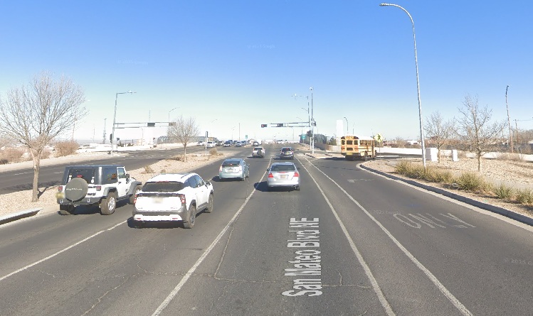

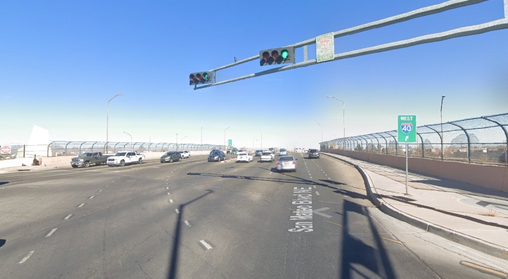
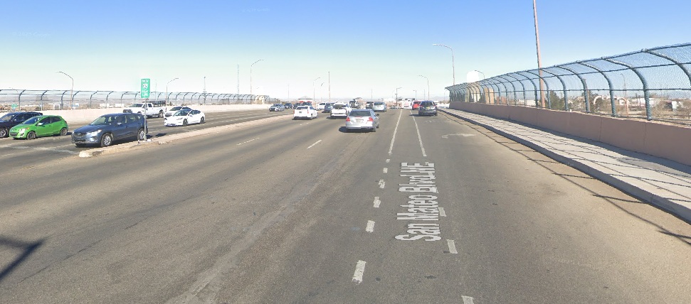
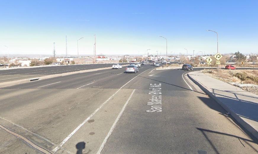
See what you’ve been missing?!?
You know the City feels entitled to “count” this in its, always proud, overall bike lane mileage? In this case, it has counted this stretch going back to at least 2011, according to Streetview, when this “lane” was added as part of the interchange bridge renovation. I wonder how many local cyclists have actually ridden on this “bike lane” in the intervening 14 or so years…
Meanwhile, you sane, sensible fellow Albuquerque cyclist have been thinking to yourself: “But that’s crazy and everybody just takes the bike/ped bridge nearby at Alvarado to cross I-40 instead.”
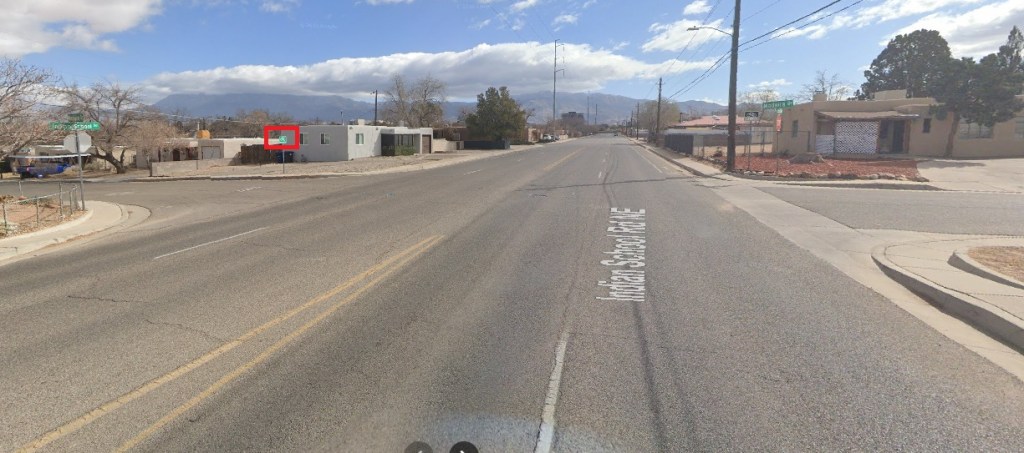
Yes, that is what WE do, but as you also know, there’s no sign on Indian School pointing cyclists toward that bike/ped bridge and a visitor to our fair city, or city resident riding this stretch for the very first time, might very well look at the City bike map and figure “Well, bike lanes are better than bike routes, and I don’t really understand what the map is telling me to do at Alvarado anyway, so I’ll just ride the bike lane down Indian School to San Mateo and cross I-40 on that bike lane.”
And that would be a very, very, very bad idea pretty much directly instructed by the City’s bike map.
By the way, the City’s interactive bike map shows the same as the .pdf version. Perhaps FAR more importantly, here’s how Google Maps suggests that one bicycle from, say, the Phillips 66 station at Indian School and San Mateo to the Denny’s on the other side of I-40 along San Mateo:
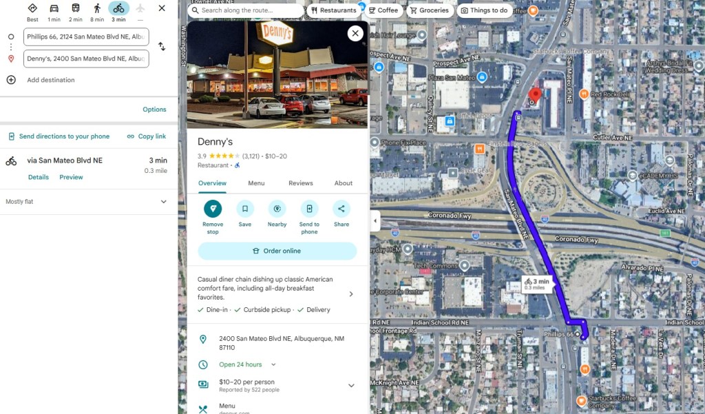
Note there’s no other suggestion to take that Alvarado bike/ped bridge. Google universally values “bike lane” over “bike route.” You just ride up San Mateo. That’s all. Heck, it only takes three minutes!
Despite what we grizzled Burque cycling veterans know from years of working in the mines, so to speak, City designation of bicycle infrastructure matters. Even if it doesn’t matter one iota to us. It also matters that the City has zero signs pointing out hugely important detours, such as taking Madeira, Palomas, or Alvarado north from Indian School to get to that bike/ped bridge.
The City needs to swallow its bike lane distance pride and de-designate the stretch of San Mateo over I-40 as a bike lane, scrub the stupid bike lane striping across that interchange, and put up signs on both west and eastbound Indian School letting folks know about the bike/ped bridge.
Today.
P.S.: I’m guessing at least one person at the City would disagree with my assertion that there’s no signage informing cyclists about the Alvarado bike/ped bridge. To wit:

Wouldn’t it be good to bring this matter, and many of the other — let’s say, “imperfections” — in the CABQ bicycle infrastructure to the attention of the CABQ bicycle coordinator? Does the city still have one? They used to, because 10 or more years ago I applied for the position (I didn’t get it, fortunately both for me and for the city).
Still, I started riding in Rio Ranch and in the CABQ back in 1989. This are certainly better in 2026 than they were in 1989.
Patrick Moore, who recalls riding for some reason down Wyoming in morning rush hour in 1989 or 1990.
LikeLike
Patrick: Thanks for your comment and suggestion. As for bringing this up to CABQ, for good or not so good, I use this forum to bring up such things with them. Sometimes it “works,” and other times it doesn’t, as I found to be the case when calling/emailing them up. To better answer your question regarding “CABQ Bicycle Coordinator,” there’s a Vision Zero staffer at CABQ DMD. I don’t know if that person has ever read Better Burque. Not that I’d blame her. – Scot
LikeLike
Re signage, having just made a neighborhood ride through this area: I was northbound on the Alvarado Officially Designated Bike Route the other day. At Indian School, the sign directed me to turn left/west onto Indian School, with no indication of a route north and over the freeway on a bike-pedestrian bridge. The signs there are actually routing cyclists who want to head north onto the far more dangerous route.
LikeLiked by 1 person