Below are a few of the many bike street, etc. improvements I rode across during my recent tour of Portugal, France, Germany and a wee bit of Spain.
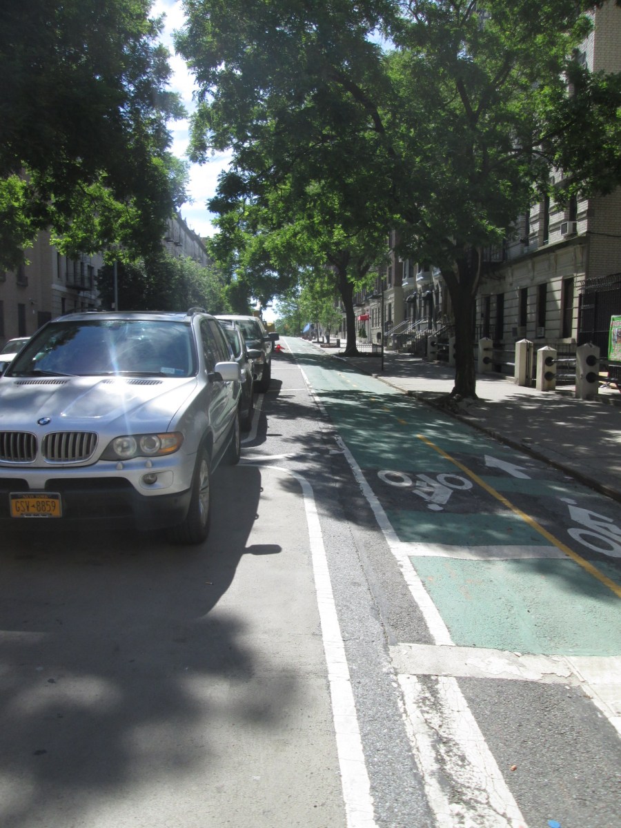 And, I forgot, New York City. I had a day there to start things off. Here’s a parking-protected two-way “cycletrack” in Washington Heights.
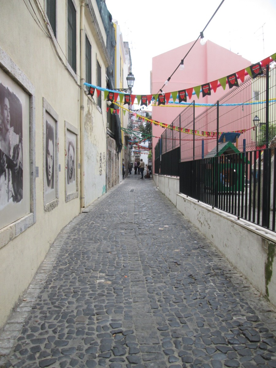 How do you keep cyclists safe? Narrow streets. Of course the cobblestones jar the rider a bit, but they help slow things down, too. You just have to avoid “distracted driving/riding” caused by the celebrity photos on the left side wall.
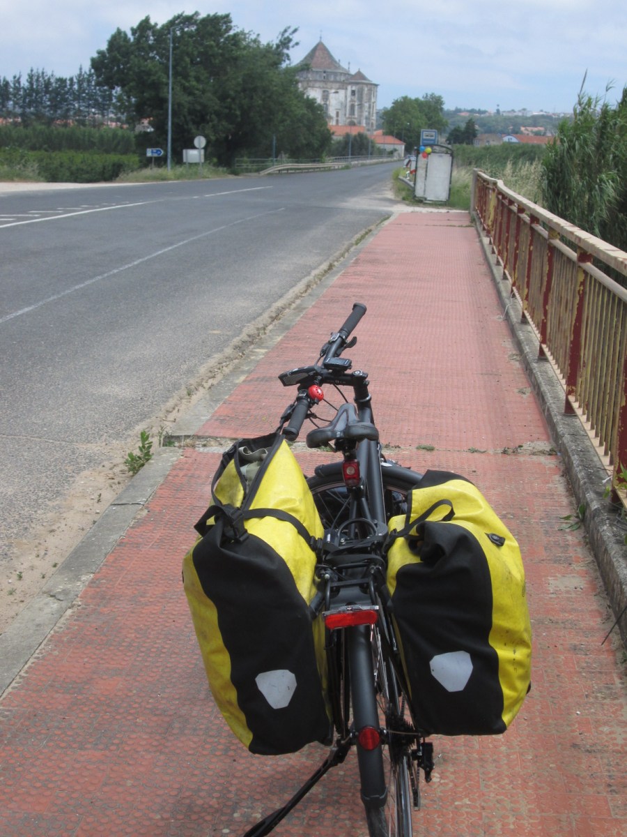 Beach towns in Portugal (and France) often have glorified sidewalk bike lanes in this shade of red. There’s often a bit of sand swept over them, but in several cases the separation from traffic helps quite a bit.
 Cycletrack colored a somewhat similar red in Lisbon. More red than kermit green here.
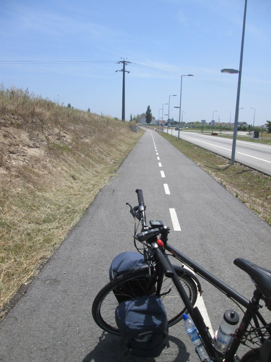
 Very clear markings on bike approaches to this road near Aveiro, Portugal.
 And these approaches led to a completely separated parallel track (note quality of pavement). This method was less common in Portugal than Germany (and almost nonexistent in France), and the newness of everything has me thinking this is the “new wave” of Portuguese thought in busier areas.
 More essential to cyclist’s safety in Portugal are the huge number of quiet country roads, such as this one between Ponte de Lima and Praia de Ancora. For every busy highway (and some of these really aren’t that busy), there seemed to be three parallel roads with zero traffic.
 Standing the bike in one of the two provided slots on the new and very clean Portuguese train from Aveiro to Braga.
 Of course Europe is all about the roundabout, which, also of course, provides a genre of public art within the roundabout itself. This one is somewhere in Portugal.
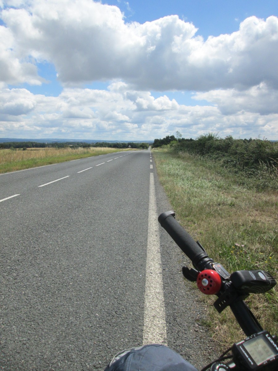
In my approximately 850 km of riding in France, I didn’t see much in the way of formal bike “infrastructure.” The biggest cycling improvement is, again, the desolate road. Photos like this make me want to start my next tour…immediately!
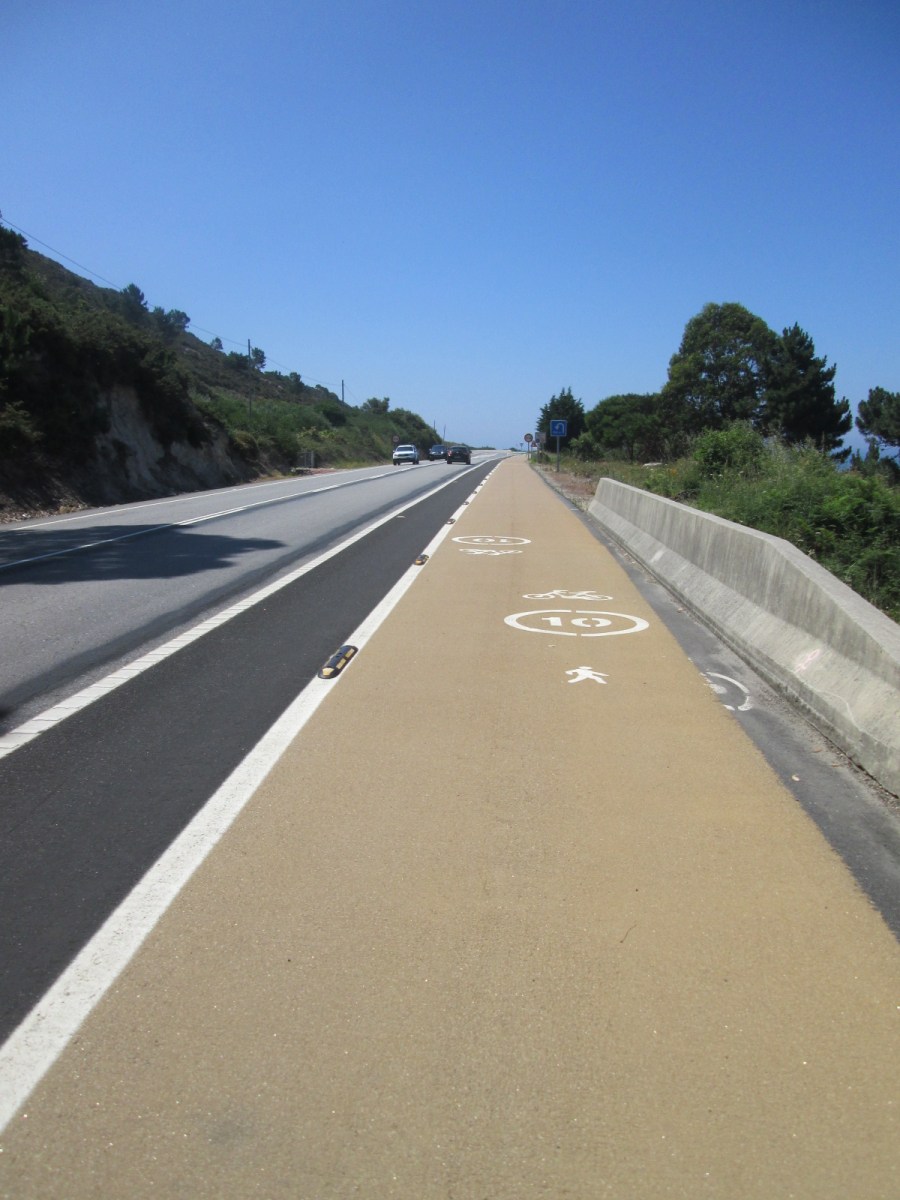 Along the coast of Spain between A Guarda and Vigo you have beautiful views and the consideration that the road is one of the most traveled “Caminos” to/from Santiago de Compostela and environs. With this is mind, the Spanish have very good separation in several stretches, with markers for walkers and cyclists. Note, too, the buffer.
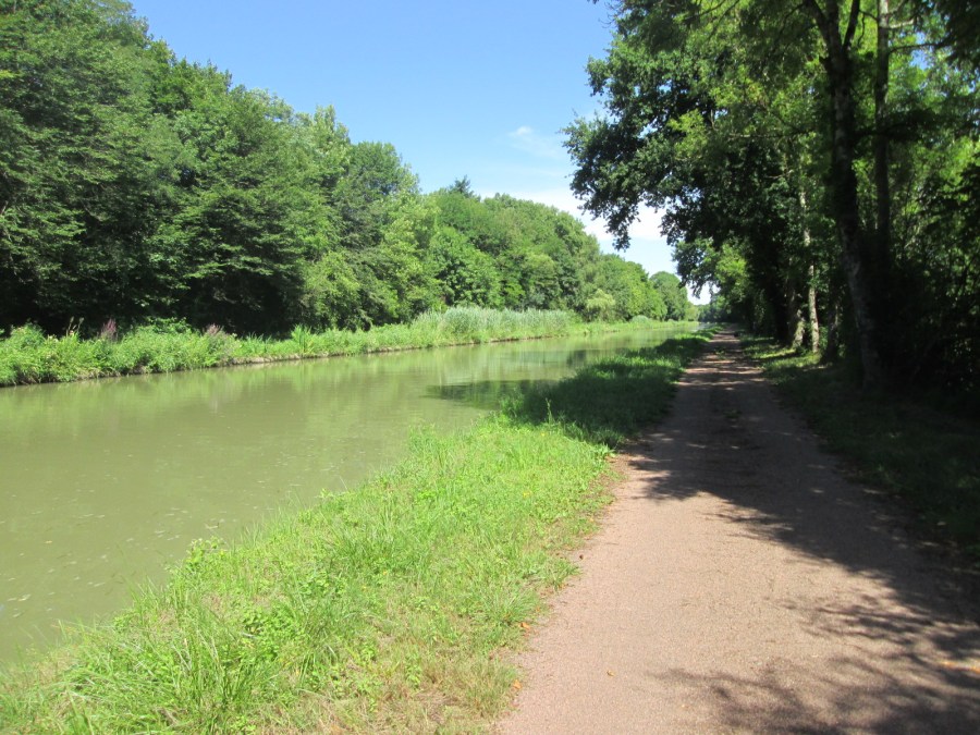 The highlight for many in riding through France is the chance to ride along one or more of the many canals. This one runs along the Loire River, with cycling on a combination of paved, cindertrack and the occasional two-track surfaces.
 But again, getting off highways and finding local “roads” that more closely resemble really good/wide bike paths is the secret in France. Here’s one outside Palinges on the way to Chalon-sur-Saone.
 The eternal train station question: Does it have an elevator to my platform? I found the answer to be yes about 75% of the time in my recent travels. One funny story, that wasn’t funny at all at the time, was finding the elevator in the Santa Apolonia station in Lisbon, then being told it couldn’t be used for bicycles. “Why?” I asked. Remember to NOT ask this question to a train station employee in Lisbon.
 The centerpiece of German cycling infrastructure, the prevalent bike signage. After having gushed about it for years, I finally started to see the point made by some that the signage is ultimately confusing, particularly in terms of routing the “official” paths (note the little colorful signs attached to the big directional signs). On this tour, I eventually stopped paying any attention to the little route signs and just focused on the towns. By the way, routing in Portugal and Germany is all about the town. In France, it’s all about the highway number, particularly for me, as the town names all looked exactly alike even after two weeks in the country.
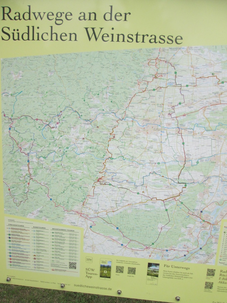 The “weinstrasse” region between the Rhine and Pfälzerwald (Palatinate Forest) also has good maps in just about every village. Keeping in mind one of the huge bike touring advantages in most of Germany, that the villages are often only 2-3 km apart, there are plenty of chances to investigate these maps (i.e., take a breather). Note also the massive number of official routes mentioned in this legend. The sheer number adds to the overall confusion.
 “E-Bike Ladestation” in Guntersblum, Germany. I saw far more e-bikes on this third tour of Germany, at least three times as many as I did in 2009 and 2012 put together. One brochure for bike rentals in the weinstrasse region promoted e-bikes thus: “1,000 hills in the wine country? No problem with an e-bike.”
 Remember, the key is to block out the overwhelming blizzard of information and just look for your next town. In this case Frankfurt on the “R3” long-distance bike route, which, as you also see if you forget to block out the overwhelming blizzard, is also on the Main Radweg, the D8 German long-distance route and another route I can’t remember. Speaking of the Main Radweg, there’s a reason for its highest rating by the German bicycle organization ADFC. Riding on it from the big town of Mainz to the bigger town of Frankfurt was “butter,” as they say.
