By Scot
A graphic, blurb, and another graphic this morning before expanding on what “it all means” later today.
Below is a visual detail from the 2016 South I-25 Corridor Study, a NMDOT-commissioned consultant look into the future of I-25 from I-40 to the Broadway exit south of town:
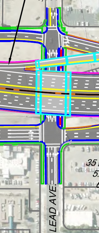
See that dark red line segment running between the two frontage roads? Here’s the explanation of that red line segment from the study:
The Lead Avenue interchange will be improved to provide a westbound on-street bicycle lane, 10-foot sidewalks buffered on the south side by a landscape strip and by a cycle track on the north side. The cycle track provides connectivity of the Silver Avenue Bike Boulevard across I-25.
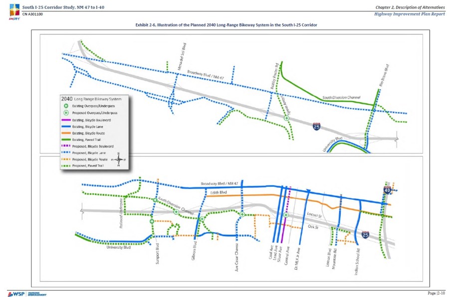
Overall, the Study took the 2040 Long Range Bikeways System Map that results from the recommendations of the Metropolitan Planning Organization (MRMPO). Here’s a detail from that System Map found in the I-25 Study:
Confused and overwhelmed yet? There’s much to take in concerning the above. Being a bona fide, but out of practice, professional educator I’ll just leave this up today, let you study it for a bit, before coming back later tonight with a scintillating lecture and “*the answer.”
Happy studying! Yes this will be on the Final!
*Spoiler Alert: I will not have anything close to “the answer.” Also, “scintillating” might be a poor choice of words.

[…] was I? Oh yes, yesterday I promised a second part to our look at the 2016 I-25 South Corridor Study and how it applies to Lead Avenue. Apologies that yesterday […]
LikeLike
Os Inchaços, Ondulações e também Sulcos a sua Celulite Pioram Se Você Não Sentir Cautela Acertado. http://supermandesign.unblog.fr/2013/07/21/sculpture-sur-pasteque/
LikeLike
It’s not my first time to pay a visit this web
site, i am browsing this web page dailly and get good
data from here everyday.
LikeLike