by Scot
This past Friday I finally got the highly informal, yet supremely official, Better Burque Cycling and Walking Count Program kicked off. I spent a half-hour at two locations. While these two intersections are only about mile apart, they just about cannot be more different.
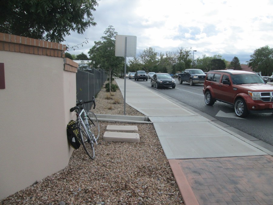
Site #1: Lead at I-25
Above is Lead looking east from the east side of I-25. The red you see against that faux stucco wall is the right edge of the “Presbyterian” sign. The cars, trucks, and SUVs you see flooding the right turn lane are as constant here as that hospital sign. Despite its designation as an important way to get to/from downtown, right down to de facto status as connector for the Silver Bike Boulevard, it’s about as cycling/walking unfriendly as you can get.
There’s a bike lane sandwiched between all those cars, trucks and SUVs, and I’ve been the “meat” in that sandwich as a cyclist many, many times. It’s only when I stand at this intersection and take photographs that I fully realize how insane I probably am for being the “pastrami.”
I took counts at and around this corner from 11:00 to 11:30 a.m. this past Friday, so not a good time for rush hour figures. My schedule only allowed for this introductory counting dabble. Here’s what I got:
Cyclists: 3
Two going down the hill WB (that’s fancy cycling/walking code for “westbound”), one coming up the sidewalk EB against traffic. I don’t believe this latter rider was using Strava, so to speak.
Walkers: 11
This count was far, far more interesting, as there’s a steady trickle of walkers further up the hill going to and from Presbyterian. Six of these folks used the crosswalk/light at Cedar, while four just made their way elsewhere between Cedar and where I stood. The only walker coming up the I-25 underpass set up for an afternoon shift panhandling at the frontage road (Oak) red light.
All in all, my limited time at this intersection reminded me of fishing in terms of standing v. action ratio. I’m looking forward to coming out at rush hour to see what it looks like.
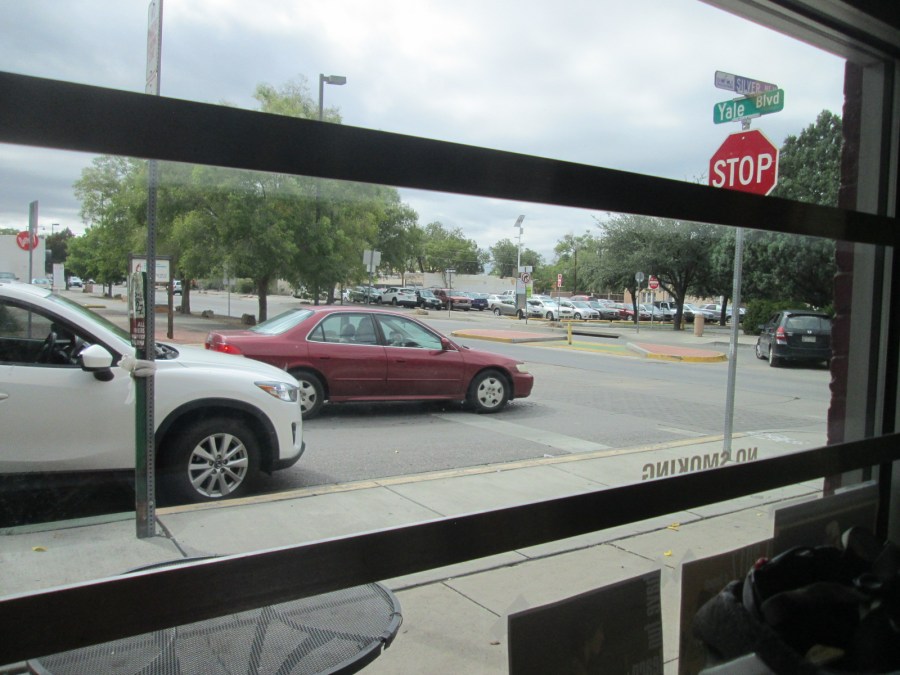
Site #2: Yale at Silver (Annapurna Restaurant)
Having stood exposed to the car-centric world at Lead/I-25 for a half-hour had me thinking another spot, a comfy chair and some chai would lead to more relaxing counts. Despite the comfortable settings, however, Yale and Silver at lunch time (11:45 to 12:15) provided so much action I had to keep putting the chai down to jot down notes:
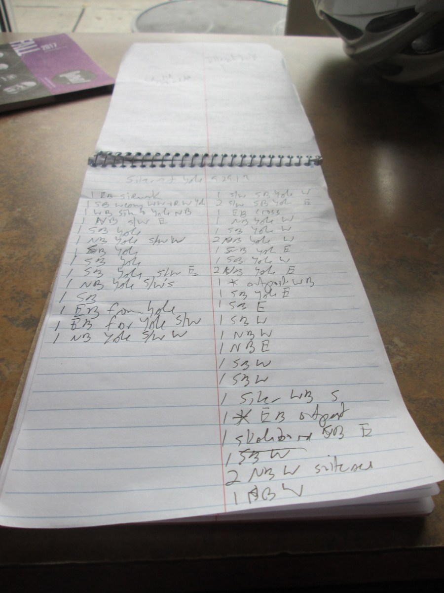
I’m still working out a “system” for keeping track, and the intensity and diversity of non-motorized travel, direction and such sorely tested the scribble method you see above. Still, I did keep track of the basics:
- Cyclists: 22
- Walkers: 63
- Skaters: 6
Teasing out the numbers above, it’s interesting that Yale (13) had more cyclists than the “bike boulevard” that is Silver (9), and that four of these Silver riders turned onto Yale, instead of riding across to continue on the bike boulevard.
As you might expect, the riders along Yale were almost exclusively either: A. Cyclists going fast; B. Cyclists using the sidewalk. On the walking side, the sheer number was exhilarating, with 50 folks walking up or down Yale in a single half-hour.
One observation from these numbers here is that the new bike boulevard treatment (median with curb-cut, green paint, bollard) has less to do with the generally mellow driver behavior here than the sheer number of walkers and cyclists. The best traffic calming comes with plenty of humans milling about. No question.
These first little forays into counting cyclists and walkers gave me a taste both of pretty good chai, and, more importantly for our purposes here, how to best keep track in my counts. Stating the obvious, it also indicated just how much more fun it is to count areas with tons of walkers and cyclists, and zero cars, trucks and SUVs zooming to get onto an interstate highway.
More counts to come, including some adjacent to that uncomfortable highway. I’ll try to imagine I’m fly fishing, and the constant sound of zooming cars is the sound of a bucolic river somewhere in Montana.
