I’m headed to the Victory Hills Neighborhood Association meeting tonight, despite not living in that neighborhood, because that Association rocks in terms of traffic studies and making its streets more walkable. It’s a wondrous organization.
Here’s the route Google Maps feels is “best” for cyclists getting to Loma Linda Community Center, host to the meeting:
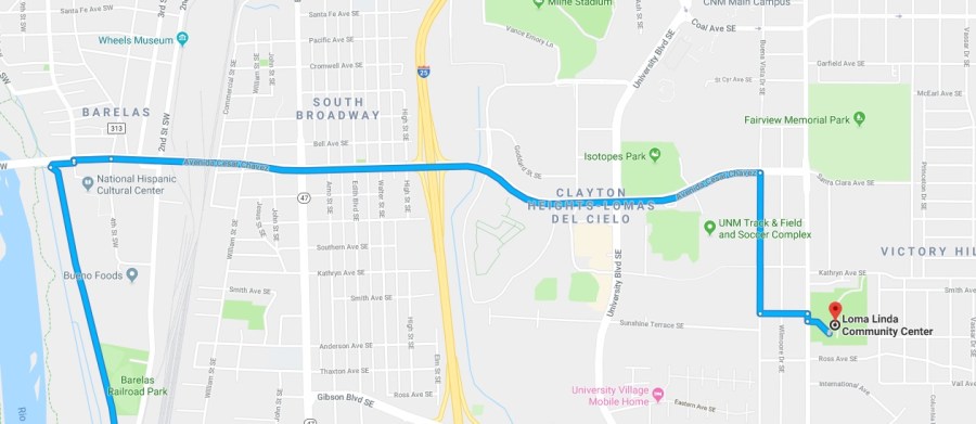
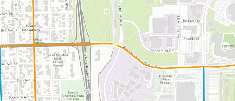
Looking closely, you can make out that Google wants me to bike Avenida Cesar Chavez east from the Bosque Path/National Hispanic Cultural Center (NHCC) to almost Yale Blvd. (Buena Vista SE). Why does Google want me to bike uphill along the ridiculously unsafe Avenida (not to mention crossing I-25?)???
Because Avenida Cesar Chaves is on the Albuquerque Bike Map as a designated “Bike Route.”
Of course it’s true one shouldn’t be insane enough to simply follow the instructions of Google or other mapping/routing “bot,” but people, being people, sometimes do. Why I happen to know a couple of guys who followed ABQ Bike Map instructions as newbie users just the other day…
Bike maps matter. In an age of somewhat/exclusively following GPS commands even more. That Avenida Cesar Chavez is designated as “bike route” in the stretch from NHCC east to Yale Blvd. has everything to do with there being no other east/west option nearby and NOTHING to do with it being anything close to a safe route for cyclists.
Caveat emptor yes, but this road as “bike route” has gotta go.
