
You might have noticed this passing, intriguing reference in Jessica Dyer’s 12/17/19 Journal story on tweaked signal timing and new “Signals Set for 30 MPH” signs going up on Lead and Coal Avenues after lengthy advocacy by neighbors along the corridor between I-25 and San Mateo.
As part of a larger Lead/Coal strategy, the city had in October asked the U.S. Federal Highway Administration to conduct a road safety audit of the corridor – something area residents requested.
But a spokesman for the city’s Department of Municipal Development said it is no longer pursuing the federal analysis of the area. The audit would obligate the city to pay for recommended changes, and funding is a factor, according to DMD spokesman Johnny Chandler. Since the city is already actively working on changes to Lead and Coal, he said it would instead seek a federal analysis of another, undetermined roadway where the recommendations might be more useful.
I don’t know what’s more intriguing in the latter paragraph above:
- “The audit would obligate the city to pay for recommended charges…” or,
- “…would instead seek a federal analysis of another, undetermined roadway where the recommendations would be more useful.”
While #1 offers fun, yet highly unlikely “obligate” (e.g., “The federal government today obligated City of Albuquerque spend $19 million for a new bike/ped overpass of I-25 at Silver Blvd.“), more realistic fun is trying to figure out what “undetermined roadway” will be seen as best choice for a federal road safety audit.
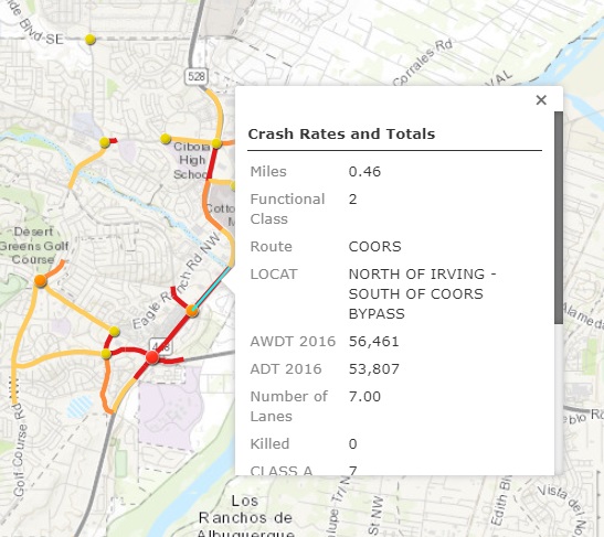
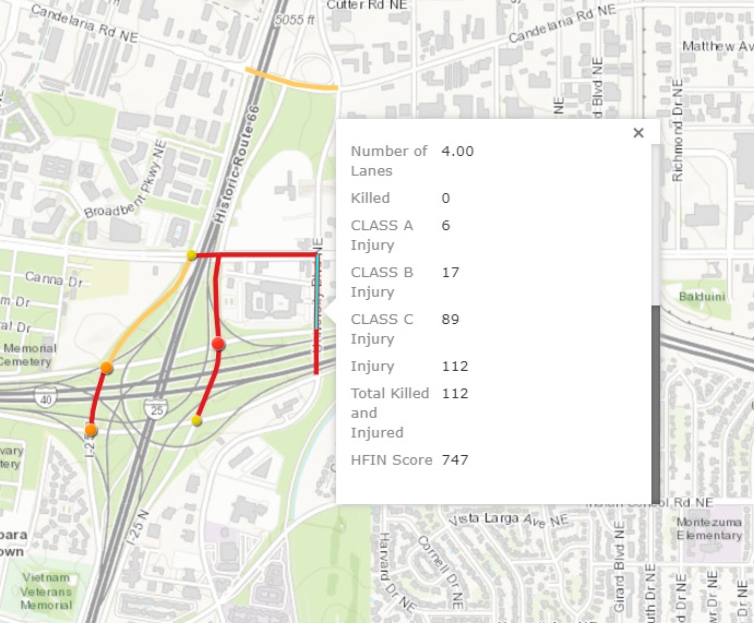
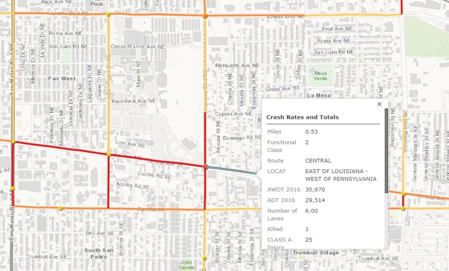
For insight into this, the City (and we) need to consult the findings of the data collection and mapping process called the “High Fatality and Injury Network,” and known as “HFIN” because government and acronyms go together like peanut butter and chocolate.

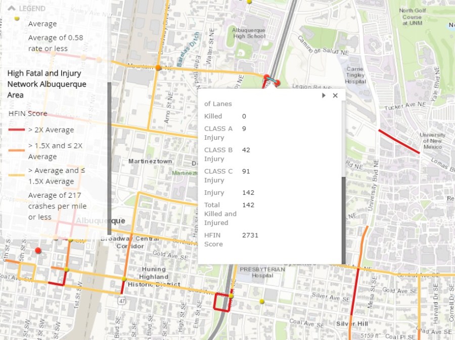
HFIN scores are calculated on a rate of fatal/injury crashes per mile factoring in length of a particular segment. Hence, the very short segment of Mountain clicked upon above has a giant HFIN score in part because of its ridiculous dangerousness and in part due to its brevity.
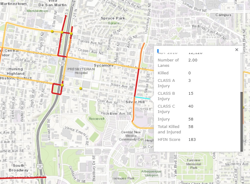
Clicking on just about all of the red segments/circles on the HFIN Map for the highest HFIN scores and keeping in mind the skewing of small segments, here’s a shortlist of best “undetermined roadway” options for the next federal road safety audit:

There are, unfortunately, plenty of other dangerous candidates for such an audit. Readers are encouraged to consult the HFIN Map to check numbers on their own “favorites.” It will be interesting to see which intersection wins this “contest,” yet the truth is a single audit or three isn’t what’s truly needed; however, the far more important systematic revamping of ABQ/County streets and stroads with a strong Vision Zero lens isn’t how this stuff works, or pretends to work.
Piecemeal. Always piecemeal.
