
As anyone dedicated to car-free travel knows, there’s no better road than a “Road Closed.”
Work on Woodward Rd. from its intersection at 2nd St. to I-25 as western continuation of Sunport Blvd. is fully in-progress. Woodward is closed at the train tracks (William St.) and many drivers haven’t figured out that 2nd is technically now open, so the walking/riding is particularly delightful.
Here’s an update, with encouragement that you get out there and see it for yourself as part of a delightful detour from the Riverside Trail (Bosque Path).

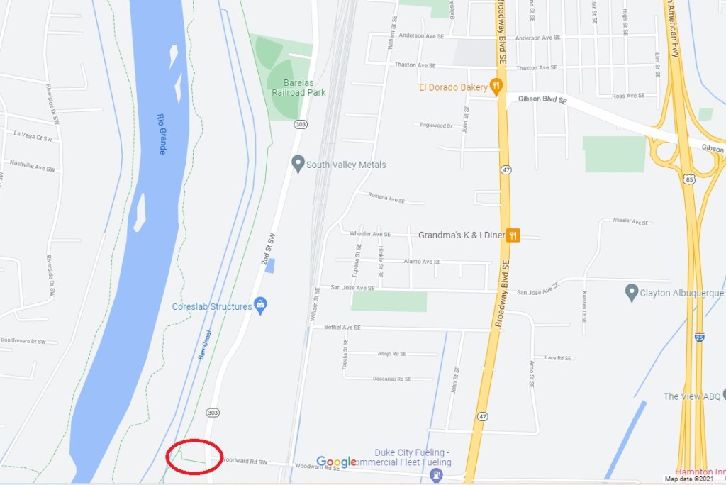
For those who don’t drop by this site often, maybe having walked/rolled through the southern reaches of the Bosque Trail without noticing, here’s a orientation map, with spur created from Trail to 2nd St. circled:

So next time you’re checking out cranes and geese at farms along the Trail, note this “off ramp” and take it. If you did so today, here’s a reverse shot of what you’d see at the end of that spur at 2nd Street:

Still unfinished and maybe not that impressive, yet, head to the other (north) side of Woodward and look the view improves:

Flipping our view east on this MUP, we get to a “funny” sign, no it’s not really funny:
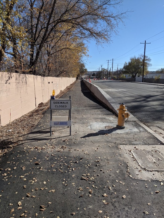
Yes, because road crews and their managers are completely obsessed with making things difficult, they often put up these “Sidewalk Closed” signs, even before remotely finishing the job of finishing the sidewalk in the first place. As many regular readers have discovered, these signs aren’t particularly heavy and can be easily transported to a place that doesn’t block users, particularly those in wheelchairs.
Currently the eastern terminus of this MUP leads only to mystery, and a chance for all of us to closely observe future developments:
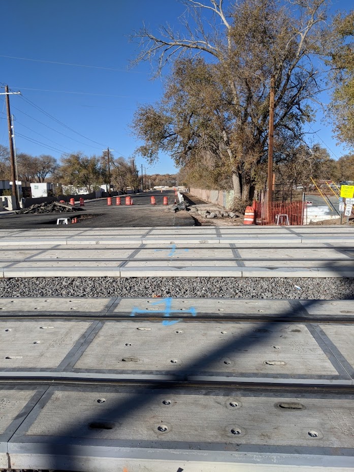
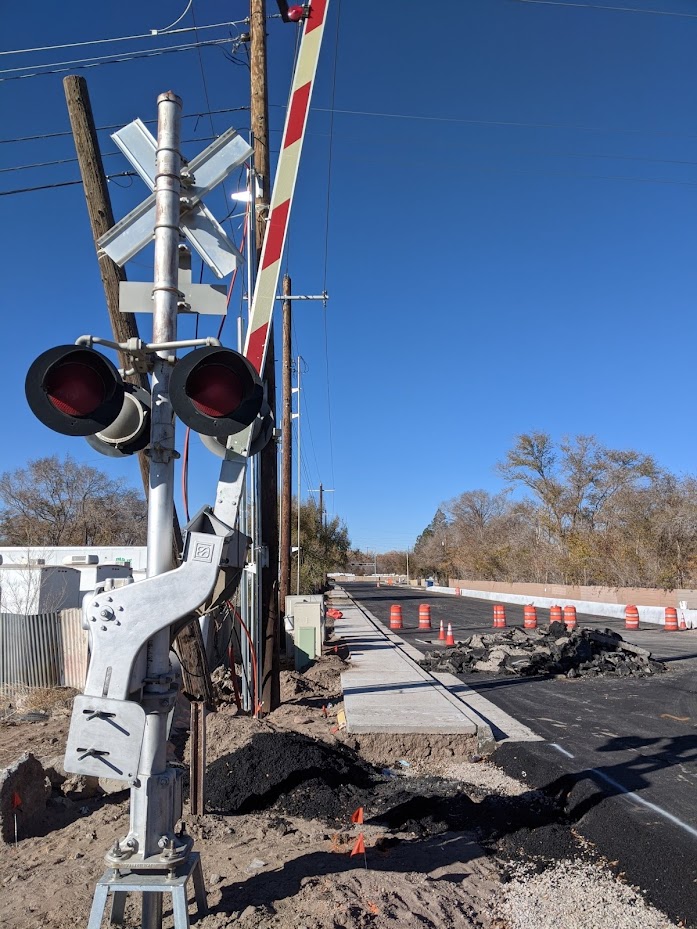
In short: How are car-free users gonna get across these train tracks?
That’s not entirely clear at present. Your humble blogger has seen a few of the earlier sketches/schematics for this crossing, and they had the MUP directly continuing on through the tracks on the north side; however, those were what are called “60%” proposals, still open to change later in the process.
Well, we’re now much, much later in the process, and it will be very interesting to see what actually gets installed here. A big factor in the planning, along with those cumbersome crossing arms, was the danger of drivers being backed up over the tracks waiting to turn left on to William St. So the idea was to put in a “golf club” median and prevent those left turns altogether.
Again, the final product here will be interesting to observe and highly important for those seeking safety in navigating their car-free way from Bosque Trail to William St. If done well, it is entirely possible that car-free use of this improved “Southeast Passage” could see an exponential jump.
Yes, it’s true that jump could be from only one or three a week (I’m totally guessing on that number) to 25, but let’s go back and look at the orienteering map one more time:
That number could be quite a bit higher (and yeah, somebody needs to do the counts needed to verify the following hypothesis). For decades, folks on the east side of the train tracks anywhere from Woodward north all the way to East Barelas have had to cross over the train tracks at Cesar Chavez/Dolores Huerta (which is kinda crazy) or at Lead/Coal to get to the Bosque Trail/River, because walking/riding William to Woodward to 2nd Street was far too dangerous (and the Trail spur was only completed a few years back).
That’s thousands of potential car-free folks who could much more easily/safely/quickly make it to our river/bosque/trail, after decades of being denied such access.
Should be fun to see what happens. And with the “Road Closed” now, it’s already fun.

This project was driven by the County to support development south of the project area although the bulk of the project area is inside the City (barely). The City had balked at the price and had repeatedly supported environmental justice claims raised by neighbors. Those claims were one reason State DOT had put off approving the project, telling the City & County to work it out. Now that it’s a reality, how were the cost and EJ issues resolved?
LikeLiked by 1 person
Michael – Thanks, that’s helpful. What is the possible development to the south?
LikeLiked by 1 person
I’ll defer to other possible readers at BernCo/COA for further details, but this admittedly dense 2018 Environmental Assessment: https://www.bernco.gov/public-works/wp-content/uploads/sites/76/2021/04/Sunport-Woodward_Signed_2018-environmental-assessment.pdf does document some of the years of neighborhood input/opposition and govt. hemming and hawing. The appendices include input from everyone from archaeologists to endangered species, to noise/traffic studies.
LikeLike