Lots of new datapoints added to the Bike Lane Effort, with a ride into the wilds of the Sunday Morning NE Heights yesterday. Streets covered included: Pennsylvania up to Osuna, Osuna around the golf course to Academy, then on to Burleson, Burleson to Wyoming, a tiny bit of Wyoming (because Wyoming sucks, even on a Sunday morning), and the fascinating “Southern Hemisphere” (i.e., water spirals the other direction) area including Burleson, Forest Hills and here on McKinney near Forest Hills:
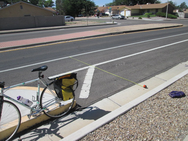
Yeah, the buffer is on the right of the bike lane in the “Southern Hemisphere” (maybe “Bermuda Triangle” works better as analogy) in this neighborhood. I’d love to hear the history of this peculiar stretch of Burque bike infrastructure. The situation also raises a big question that needs to be included in the eventual data set: When was the striping last done?
My riding buddy and I tried to use clues (wear of bike lane stripe, etc.) in the area, but that’s just guessing and the data is almost certainly available without an IPRA request or such nonsense.
Anyone interested in discovering, and measuring, similarly wild outposts of bike lane striping around town can just email me for the latest spreadsheet. I’d really appreciate a somewhat braver rider to tackle the rest of Wyoming (we only did two points on either side of San Antonio). We also didn’t get up Spain Rd. yesterday and that’s still a sizable hole in the dataset.
