
By Scot Key
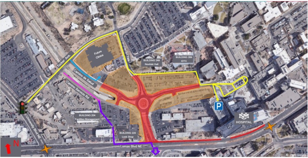
Hey, North Diversion Trail User: How are you getting through the ongoing UNMH construction to get to/from UNM and environs? Because, as you know, all the roads/roundabouts in red below are all tore to Hell:
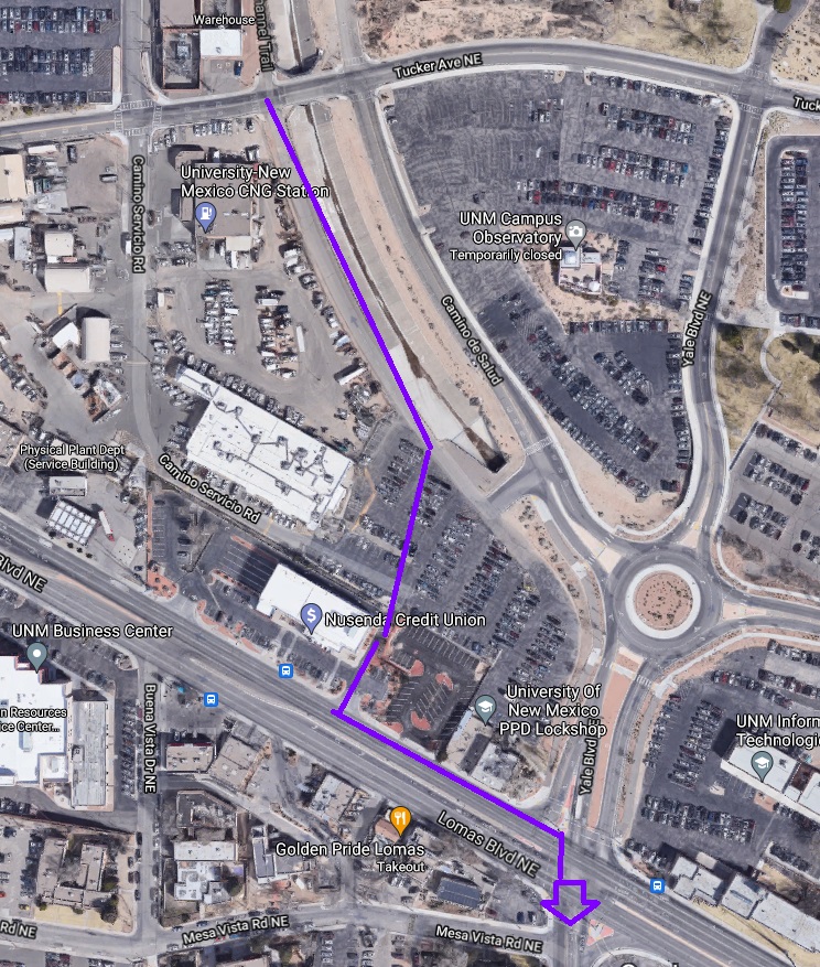
Just wondering (be honest): Does your route maybe look something like this?
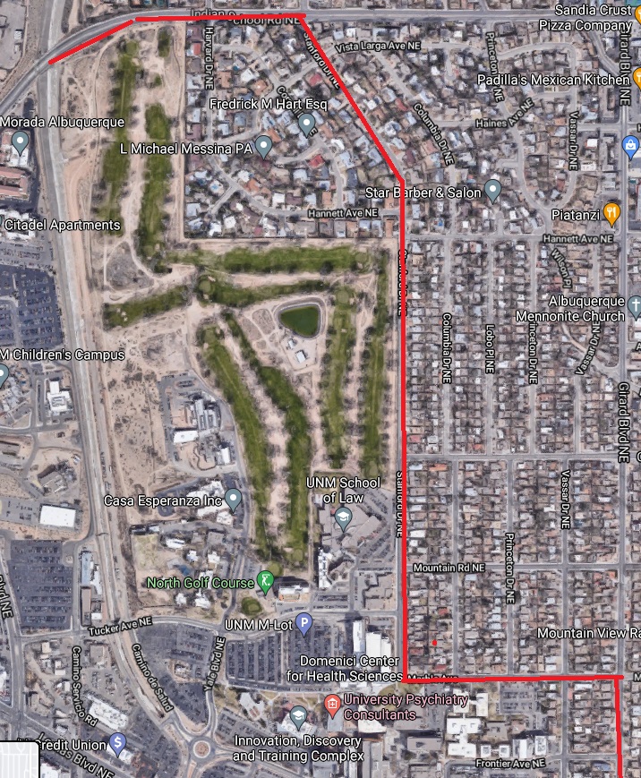
I ask because during a visit to the UNMH construction site this past weekend I saw several cyclists and walkers generally following the purple route above. That’s not what the construction “temporary traffic plan” and planners want you to do. They want you to do something like this instead:
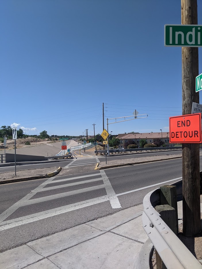
There are even detour signs at grade level of Indian School showing start/end of this proscribed detour.
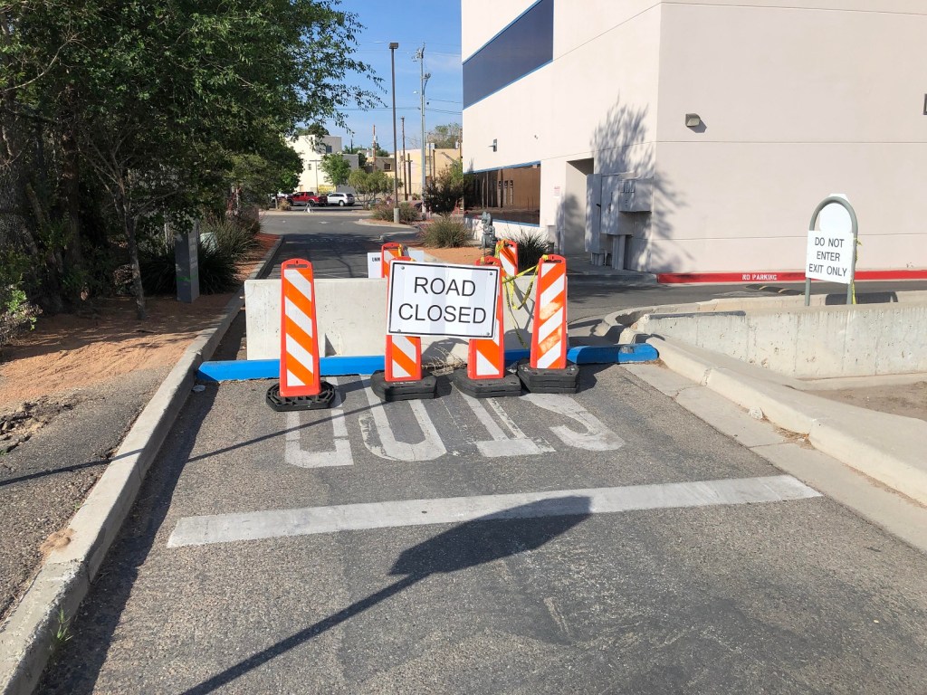
The far from official route many are taking is much quicker, but does involve crossings such as this through the NUSENDA parking lot:
The smorgasbord of blockages notwithstanding, folks are still walking/walking their bikes right over this venturing on, if southbound, to the northside sidewalk of Lomas and beyond.
BB has been told that something close to the old route from NDC to Lomas/Yale will return around the end of July, in time for what looks to be a fully in-person Fall Semester at UNM. With the NDC bike/ped counter at Indian School registering over 10,000 users a month, winter months aside, and with the new notch under Indian School sure to attract even more users, restoring a sane, safe, and less time/effort route is hugely important.
Evidence of just how important can be found if you spend just a few minutes at Yale/Lomas. Chances are that even in a scant few minutes, you’ll see at least a few of those 10,000 a month undertaking a route like this:
Be safe out there, everybody. Especially safe at what’s left of Yale and Lomas.

Found your page because of my frustration with this project. Even just trying to get to *UNMH* from Tucker has become a nightmare. Not to mention the now-complete absence of sidewalks on the north side of Lomas–I have seen an insane number of hospital workers risking life and limb just to try to walk a couple of blocks. Imagine surviving 18 months of COVID and then getting taken out by some bozo doing 50 mph down Lomas. It’s a disaster waiting to happen.
LikeLike