
Riding a bicycle through Albuquerque streets is a case of going where drivers don’t and understanding the streets are all about those drivers. Example:

This is Ocala St. S.E., almost to Four Hills in the far SE part of town. Maybe you live up there, or maybe you’re from downhill (west) and you’ve heard there’s a good way to get home down this street, but as Singing Arrow SE changes name to Ocala, things are curving south. Hmm…where’s the route?
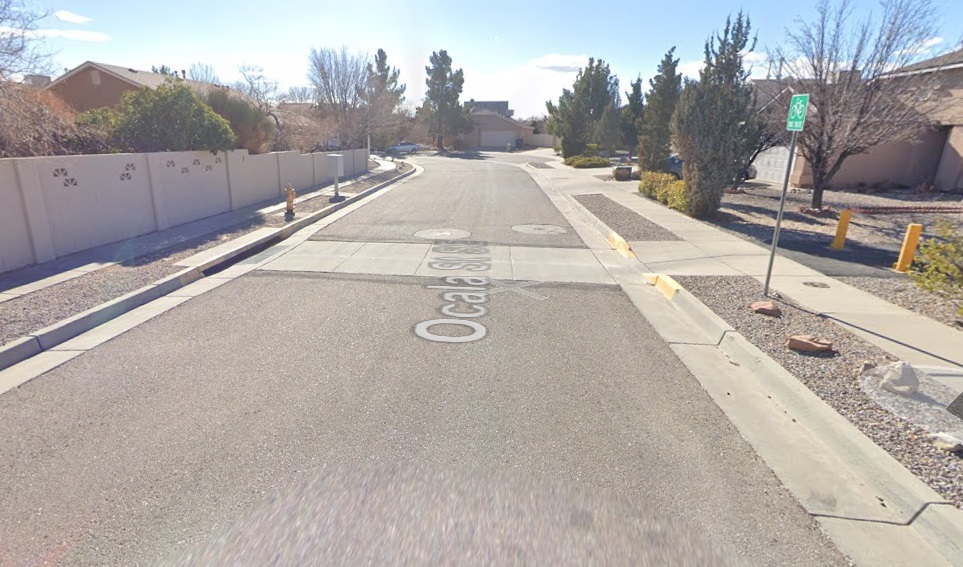
A few seconds later, you’ve made the curve. Now keep in mind the image above looks different when you’re riding 10-12 mph or so. Staring at it now, you can just make out the “Bike Route” sign to the right. If you’ve been doing this a bit, the sign doesn’t tell you nearly as much as the two bright yellow bollards (Pro tip: Look for the bollards). Still, even as a still shot, there’s a question: Why isn’t the “bike route” sign facing me, with a little arrow.
Because, remember, this is a street. It’s all set up for drivers.
By the way, if you’re new to Singing Arrow/Ocala, and/or cannot distinguish street scenes like above (because ABQ has about 900 identically-looking neighborhoods), here’s a look:
We’re south of Central (hence SE roads) and almost to where Central runs into I-40. Also notice that little red box surrounding a tiny green line segment, because….if you’re lucky enough to stop that first time and get a really good look:

It all becomes clear. There’s a multi-use path between these two homes enabling connection west, and a “Bike Route” sign telling you this ONLY if you stop. So much of ABQ is like this, or at least enough of it that good local knowledge is essential in connecting a bike network set up by people who never ride bikes.
In the case of Ocala SE, quite a few folks do have the local knowledge, even non-locals. There’s this somewhat popular activity tracking app called Strava that is used by quite a few cyclists, but not nearly all of them. Strava aggregates member rides and plays very well with a number of related apps, allowing interested cyclists to spend WAY TOO MUCH of their time digging into their exploits.
One Strava feature is a “Global Heatmap” that enables one to see where Strava users ride (or run, etc.). Here’s a close-up look at the Heatmap at Ocala SE, first without the “heat” (i.e., without visual indication of where folks are riding):
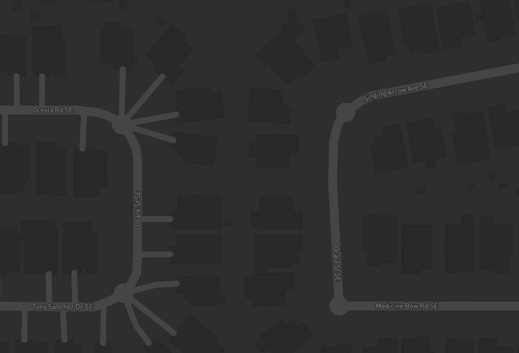
Note the little gap betweenhomes bridging Ocala and Ozark SE. Now here’s the same look with “the heat.”
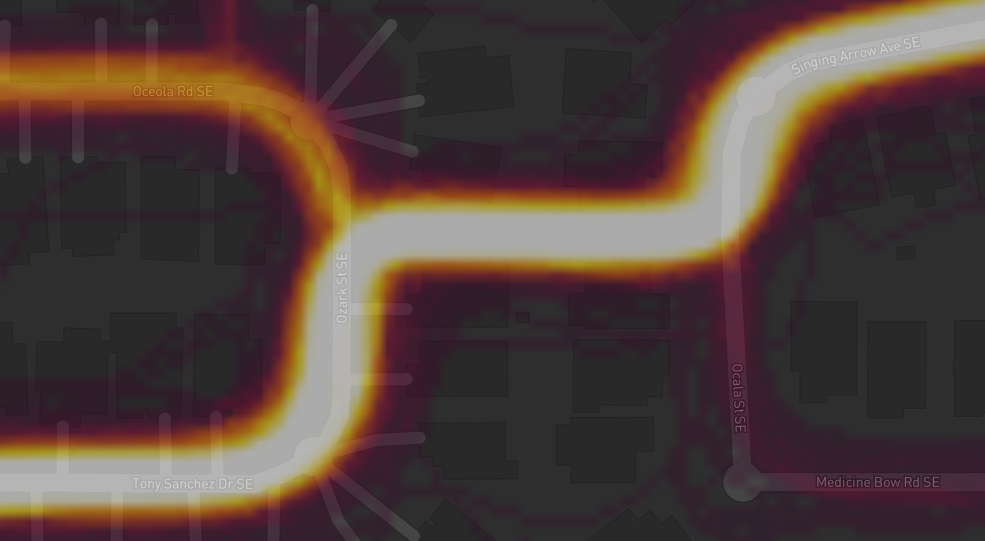
The faint red heading south down Ocala to Medicine Bow SE indicates far fewer riders. These are largely Strava users who missed the sign/bollards. The somewhat brighter orange at top-left indicates greater usage, while the very bright orange-yellow indicates far more cyclists going down the obscurely-signed path and heading south and then west from there on the wonderfully named Tony Sanchez Dr. SE.
Today’s technology makes it very easy, although spendy, to route rides in places unknown to us. A Strava account is now $80 a year, for instance. Riders can also route first-time rides/areas via a ton of other apps (many paid) and/or bike computers. But for those without those resources, or interest in the digging in necessary for their use, there’s only signs.
And signs like this, facing the wrong way:

Maybe we shouldn’t have to play “Spot the Route” like this, but as long as those in charge of design/implementation of our streets drive, and only drive, our “game” will have to continue.
Happy playing.
