
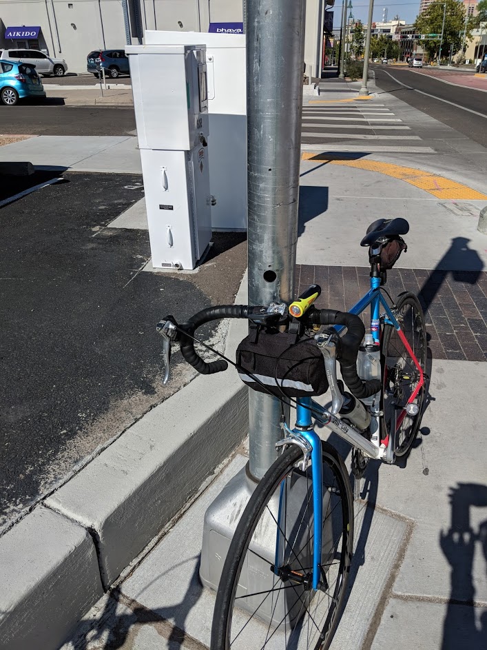
The Better Burque Tactical Urbanism Team (BBTUT: Look for us at 311/SeeClickFix!) had more work that it could handle today, Sunday, during its semi-official weekly ride. Several spots involved issues along Central Avenue, including several HAWK signals that have yet to be put into operation, including at Walter:
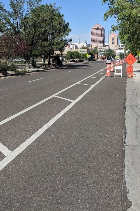
Not having any beg buttons and electrical wiring on-hand, BBTUT merely 311/SeeClickFixed (yeah, it’s a verb) a few spots, including some newish bike lane striping that is patently substandard (33-35 inches in our measurements) on southbound Rio Grande Boulevard between Don Fernando and Indian School.

BBTUT had read of this situation via 311/SeeClickFix, and yup, that newish bike lane is nowhere near up to standard. We also had a chance to measure the right driving lane (while dodging a few cars) and it’s 12-feet wide. This would make this striping a double fail, as 10.5 feet is now standard, even on streets such as Rio Grande Blvd. with bus traffic. In short, we gotta steal at least 1.5 feet from the driving lane(s) and give it back to the southbound bike lane (it measured at 44 inches prior to restriping in Better Burque’s Bike Lane Measurement Project).
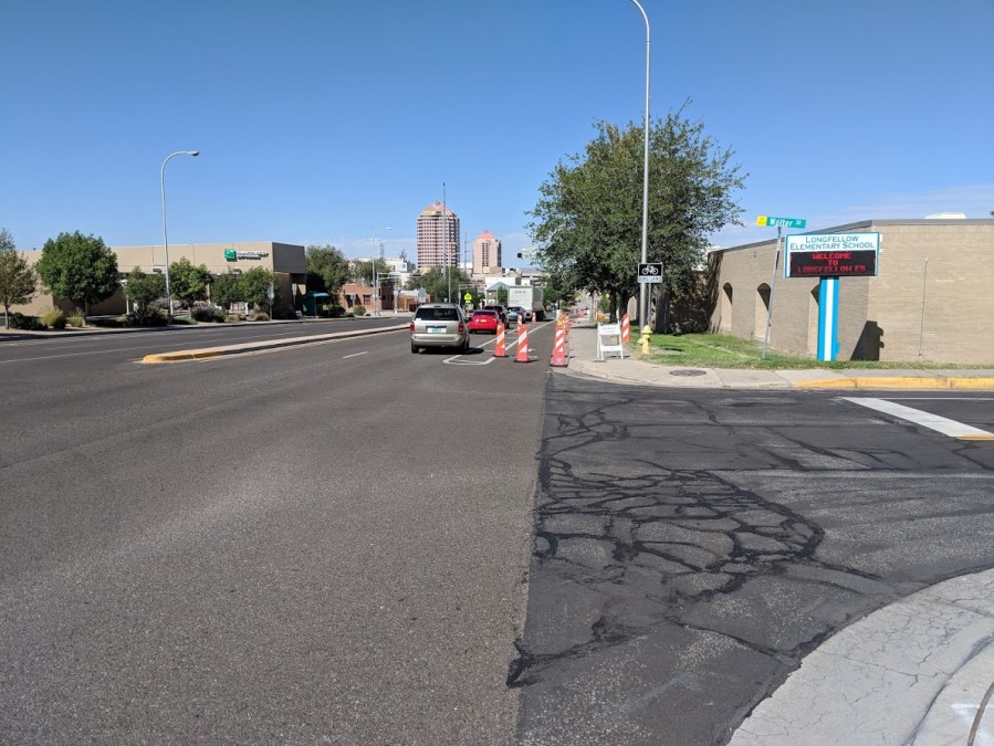
Our aggravation and work load finally resulted in something we could more immediately “fix” on MLK Boulevard westbound between St. Joseph’s Hospital and Edith Boulevard. Here in our “Before” shot, we see the “bike lane closed” sign placed in the bike lane along with the (cue eye-roll) “Share the Road” sign.
Further investigation showed that the actual work which caused all this signage was west of Edith, a few hundred feet away from this initial closure sign.

It took a few minutes to eye-ball the situation, but the upshot is that construction contractors are having a bit of trouble adjusting to a roadway world that includes bike lane buffers. Hence, instead of incorporating the buffer into an even better situation for cyclists, we get scenes like this at Walter:
Having assessed things and definitely not wanting to endanger anybody while improving the few hundred feet before any work is actually being done (of course, this work was not being done on a Sunday morning, and the construction crew really should move all these signs out of the way on Friday afternoon for the weekend), BBTUT came up with the following “After” solutions:

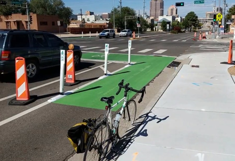
BBTUT also moved the “Sidewalk Closed” sing from the sidewalk to the gutter, but forgot to take a photo of that. All in all, this small improvement job will help cycling and walking safety, but follow-up is needed to enlighten all involved in this and other jobs about the great possibilities offered by bike lane buffers (and sidewalks in front of elementary schools).
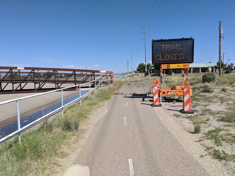
BBTUT’s long day’s journey into bad cycling signage ended with a visit to this sign. Can you guess where this photo was taken (no peeking!)?
Think about it.
Think.
Yeah, you’ve been here before, but you very probably haven’t been precisely where your BBTUT photographer is standing to take this photo. Where is this?
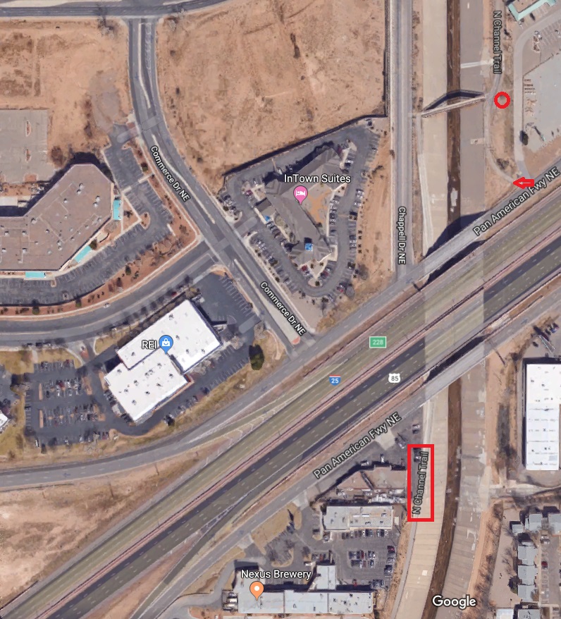
Did you guess the spot? What your humble blog poster can admit about this spot is that in my 15 years or so of cycling the North Diversion Channel Trail (NDC) I have NEVER noticed that this little spur to Pan American (I-25 Frontage Road) even exists.
The trail closure (info here) sign for those headed northbound is in a place where nobody will see it. Okay, that’s an exaggeration. It’s in a place that 99.9999999999999% of NDC users won’t see it. Besides, if you’re one of those who rides Pan American frontage road southbound to get to North Diversion Channel Trail, what’s a little trail closure? You have your hands full staying alive riding the Pan American frontage road.
Reports have and will continue to be made about the erroneously placed sign, and it’s quite true that the long day’s journey BBTUT had this fine Sunday morning and early afternoon will include follow-up in coming days. Truthfully stated, it wasn’t the most fun day of tactical urbanism ever, but a bad day of tactical urbanism beats a good day of fishing, anytime.

Yeah, I rode that yesterday, and was just saying in my head “WTF?”
I think, but am not sure, that is was do to throwing a little hot tar, into the gaping crevasses. that make up 15% of the path, but it sure didn’t look closed to me, and no sign that I saw said it was. Now I know. I took it both ways.
I also saw the MLK debacle. The only reason for them forcing me into mixing it up with speeding cars that I saw was (at 30 mph), for them to have someplace to park. That was the only thing blocking the bike lane. Their cars.
Seattle has an ordinance where, if contractors must block the bikelane or sidewalk, they must make a useable detour. That includes taking a driving lane. That would likely have made them think twice about closing it so they could park there. Because it would have been a lot less work to park in the lot!
LikeLike
[…] mentioned a couple of days ago the very not Complete Streets striping work recently done southbound on Rio Grande Boulevard. […]
LikeLike